
Portland’s housing market rewards listings that get noticed fast. Buyers scroll through dozens of homes in a single sitting, and a row of similar ground-level photos rarely makes anyone stop. That is why more local agents are adding drone footage for real estate to their marketing. A view from above shows what a front-door photo cannot: the lot, the neighbors, the water, and how it all fits together.
For most buyers, online photos are the first showing. The National Association of Realtors notes that buyers rank photos as the top website feature, ahead of even the home description. In a competitive market, that puts pressure on every image in a listing to earn attention. Aerial images help because they add information and variety. Instead of repeating similar interior and exterior views, a listing can open with a striking overview that sets the scene.
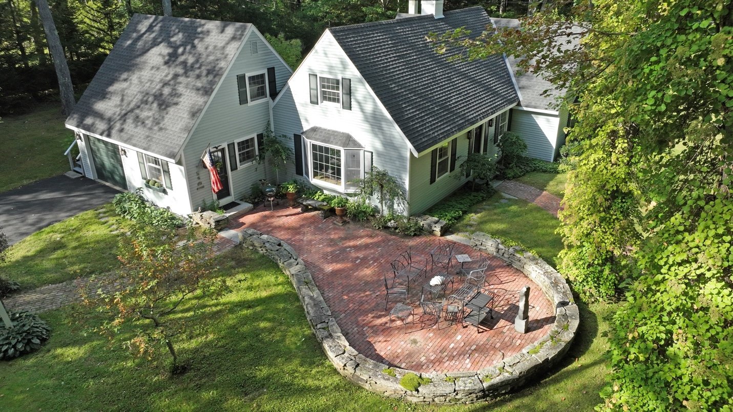
Much of Portland’s appeal is about location: the Old Port, views of Casco Bay, nearby parks, and the working waterfront. Real estate drone photos can show those relationships clearly, helping buyers see how close a condo sits to the harbor or how private a lot feels on a busy street. For larger properties, such as waterfront homes, multi-unit buildings, or land, aerial images reveal boundaries, acreage, and outbuildings. Roof condition and orientation are visible at a glance, which can answer questions before a showing is ever scheduled.
Video adds movement and context. Real estate aerial video tours can begin high above the street, glide toward the front door, and continue inside, creating one continuous sense of place. This is especially useful for relocating and out-of-state buyers who may meet a Portland home for the first time on a screen. Pairing video with high-resolution aerial photography gives agents a full set of marketing assets from a single visit. Steady flight paths and thoughtful professional editing keep the result polished enough to share on the MLS, social media, and listing websites.
Not every drone shoot is equal. Commercial flights in the United States fall under FAA rules for commercial operators, and properties near the airport or busy waterfront areas may involve airspace considerations. Agents benefit from working with operators who understand these requirements and plan each flight around them.
Quality Aerials is a family-owned company based in Falmouth, just north of Portland, led by Jack Stepp, a professional photographer with nearly 30 years of experience. As a professional drone photographer and chief pilot, Jack plans and flies each listing shoot personally, with no handoffs to freelancers.
Every flight is handled by a licensed drone pilot, and edited photos and video are typically delivered within 24 to 48 hours, which suits fast-moving listings. Our aerial photography services cover Portland, South Portland, Scarborough, Westbrook, and Windham, and examples of finished work are available in the portfolio.
Have a listing coming up? Schedule your shoot with Quality Aerials and give your next listing the view it deserves.