When people browse property listings today, they expect more than a few ground-level photos and a brief description. They want context. They want perspective. They want to understand how a home actually fits into its surroundings before they ever set foot inside. That is exactly why drone photography has become such a powerful tool for real estate listings.
Aerial imagery gives buyers something traditional photography simply cannot provide. It shows scale, reveals layout, and connects the property to its environment. Whether someone is searching for a primary residence, a vacation home, or a rental investment, seeing the bigger picture matters.
That is where real estate drone photography changes the experience. It helps buyers imagine how life would feel in that space, not just how a room looks from one corner.
And that shift in perspective makes a measurable difference in how properties are viewed, understood, and remembered.
When people scroll through listings, they are not just evaluating square footage or the number of bedrooms. They are trying to picture daily life.
Ground-level images rarely answer these questions clearly. They show details but often miss context. A home might look spacious indoors, but sit tightly between neighboring houses. A rental property may appear attractive but be just steps from a busy highway. Without an aerial perspective, buyers fill in the blanks themselves.
Drone photography for real estate listings removes that guesswork. It shows the property in relation to everything around it. Buyers can see how the driveway curves, how the landscaping flows, and how the home sits within the neighborhood.
That clarity builds confidence. And confident buyers move faster.
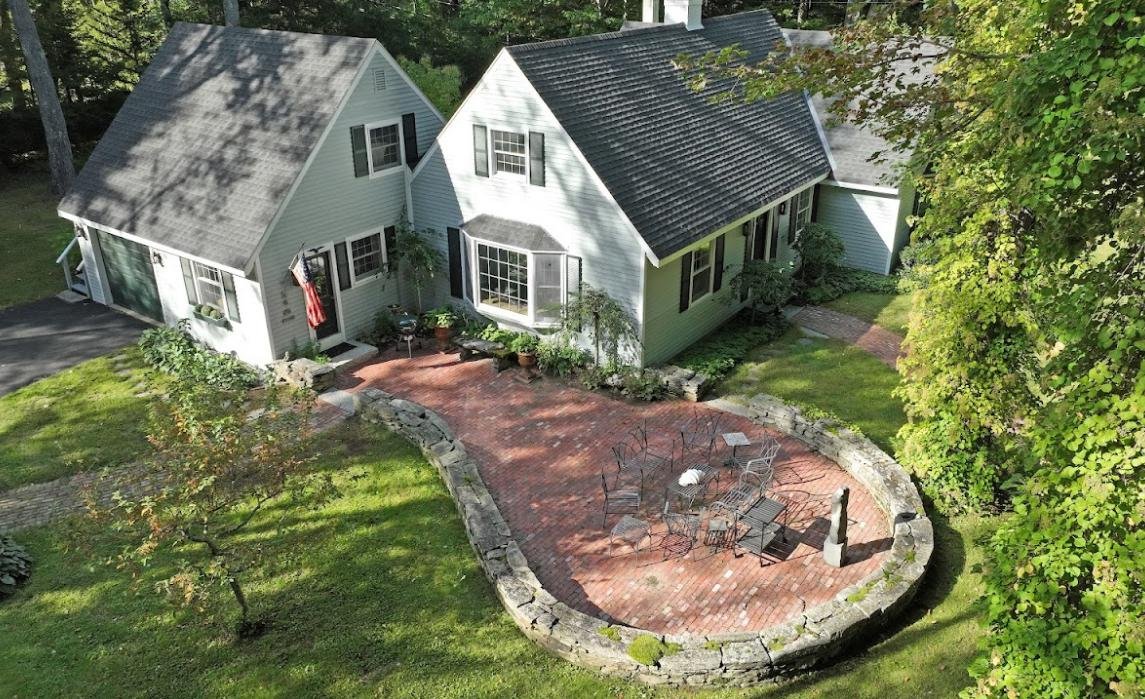
Scale is one of the hardest things to communicate through standard photography. A backyard may look large in one image and small in another, depending on lens choice and angle. Interior photos can make rooms appear bigger or smaller than they actually are.
With real estate drone photography, scale becomes obvious.
An overhead shot shows how the house compares to nearby properties. A high-angle view reveals the true size of a lot. Buyers can see the distance between structures, the depth of outdoor spaces, and the relationship between the home and the surrounding land.
This is especially important for:
For example, someone shopping for a lake house wants to know how far the dock sits from the house. A family considering a suburban home wants to see the size of the backyard compared to neighboring lots. A traveler booking a private rental wants to understand how secluded the property feels.
Drone photography for real estate listings delivers that visual truth in seconds.
Floor plans are helpful, but many buyers struggle to interpret them. They require effort and imagination. Most people prefer visuals that instantly make sense.
Aerial images help connect the dots.
With real estate drone photography, viewers can see how different areas of the property relate to each other. They understand where the garage sits in relation to the house. They see how the patio connects to the pool. They notice the path from the driveway to the front entrance.
This is especially useful for properties with complex layouts, including:
For Airbnb and VRBO hosts, layout visibility can influence bookings. Guests want to know how far the parking area is from the entrance. They want to see where the outdoor seating sits relative to the house. They want reassurance that the pool is private.
Drone photography for real estate listings answers these questions without requiring explanation.
Link: https://drive.google.com/file/d/1SQ8inRITBJ9Gk9HYd_w1lLc2Uvfw4zCY/view?usp=sharing
Image filename: location
Alt-text: An aerial photograph of a neighborhood
Caption: Real estate drone photography captures the details of a location naturally
Location has always been a key factor in real estate. But buyers today want to see the location, and not just read about it.
They want proof of proximity.
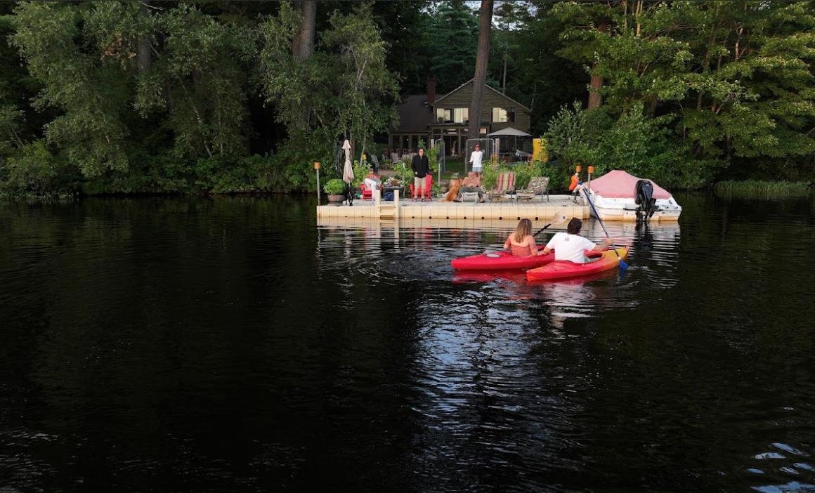
Real estate drone photography captures these details naturally. Wide aerial shots reveal nearby features that influence buying decisions. A home overlooking a golf course looks entirely different when seen from above. A rental property near a scenic coastline becomes more appealing when guests can actually see the view they will wake up to.
This is especially powerful for vacation homes and short-term rentals. Travelers often choose properties based on atmosphere. They want to feel immersed in the environment.
With drone photography for real estate listings, the surroundings become part of the story instead of a footnote in the description.
Many properties include outdoor amenities that are difficult to capture from ground level. Pools, decks, gardens, patios, fire pits, and landscaped grounds all play a major role in how people experience a home.
Traditional photography can show pieces of these features, but rarely the full picture.
Real estate drone photography presents outdoor spaces as a cohesive environment. Buyers can see how everything connects. They understand the size of the pool area, the shape of the garden, and the flow between indoor and outdoor living spaces.
This is particularly important for:
When people browse listings for summer homes or rental retreats, outdoor space often drives the decision. Aerial imagery helps those features stand out immediately.
Real estate photography is not only about selling homes. Rental markets rely heavily on visual appeal.
Property owners listing on Airbnb, VRBO, or private rental platforms compete for attention in crowded marketplaces. Guests scroll quickly. They make decisions based on emotional reactions as much as practical considerations.
Drone photography for real estate listings helps rental properties stand out in a powerful way.
Aerial shots show privacy, scenery, and accessibility. Guests can see how close the rental is to the beach, hiking trails, ski slopes, or city attractions. They understand the setting before they book.
For hosts, this can lead to:
Real estate drone photography turns a simple listing into an immersive preview of the guest experience.
People make many real estate decisions emotionally, even when they believe they are being logical.
A wide aerial shot of a home nestled among trees or overlooking water creates an immediate emotional response. It feels peaceful. Inviting. Aspirational.
Ground-level photos can show beauty, but aerial views create atmosphere.
With drone photography for real estate listings, viewers do not just see a structure. They see a setting. They imagine morning light over the property. They picture gatherings in outdoor spaces. They sense privacy or openness depending on the landscape.
This emotional engagement often determines whether someone clicks for more details or keeps scrolling.
Many listings look similar at first glance. Standard interior shots follow predictable patterns. Living room. Kitchen. Bedroom. Bathroom. Exterior front.
Aerial photography breaks that pattern.
Real estate drone photography introduces visual variety that immediately captures attention. Listings that include aerial images feel more complete and more polished. They stand out in search results and listing platforms.
For agents and property owners, differentiation matters. When buyers compare multiple listings side by side, the ones with clear aerial perspectives often feel more informative and more trustworthy.
That perception influences how long viewers stay on the listing and whether they schedule a showing.
One of the biggest concerns buyers and renters have is uncertainty. They worry that photos might hide important details. Aerial imagery reduces that worry.
Drone photography for real estate listings shows the property openly. Buyers can see neighboring homes, nearby roads, and surrounding land. There is less mystery.
Transparency builds confidence. When people feel they understand what they are viewing, they are more comfortable moving forward. For rental properties, this transparency can reduce complaints and misunderstandings. Guests arrive knowing exactly what to expect.
Link: https://drive.google.com/file/d/1khqw9RNgAtEpOytT6-a7oqs-MQ0G_KJx/view?usp=sharing
Image filename: unique-properties
Alt-text: Drone photography of buildings
Caption: Market unique properties with drone photography
Some properties are simply difficult to capture with traditional photography.
Examples include:
In these cases, real estate drone photography is not just helpful. It is essential.
Aerial footage communicates the full scope of the property in a way ground photography cannot match. Buyers who specifically want land, privacy, or unique geography rely heavily on these visuals.
Without drone photography for real estate listings, these properties often appear incomplete or underrepresented.
When listings include detailed aerial views, viewers gain a stronger understanding of what the property offers. That clarity tends to attract more serious inquiries.
People who reach out already know what they are interested in. They have fewer surprises during showings. They ask more focused questions.
For agents and property owners, this can mean:
Real estate drone photography helps filter casual curiosity from genuine interest.
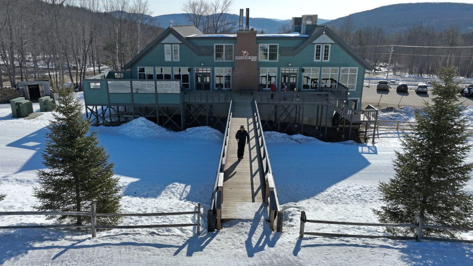
Many properties shine during specific seasons or support particular lifestyles. A ski chalet near the slopes. A lake house perfect for summer boating. A countryside retreat surrounded by fall foliage. Aerial imagery highlights these lifestyle connections.
Drone photography for real estate listings can capture shoreline access, mountain proximity, or expansive green landscapes. It places the home within the experience buyers are seeking.
For vacation rentals and second homes, this is especially powerful. Buyers and guests are often purchasing a lifestyle as much as a property.
Aerial images are not only useful on listing pages. They enhance many forms of property marketing.
Real estate drone photography works well in:
Because aerial visuals are striking and informative, they adapt easily across platforms. A single high-quality aerial shot can support multiple marketing efforts.
Buyers often choose neighborhoods as much as homes. They want to understand density, green space, and overall layout.
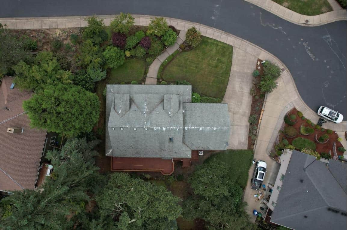
Drone photography for real estate listings reveals neighborhood patterns clearly. Buyers can see tree coverage, street design, and proximity to amenities. They can identify cul-de-sacs, open spaces, and community features. This information helps them imagine daily life beyond the property line.
When people shop for summer homes or seasonal retreats, location and environment carry extra weight. They want scenery, privacy, and recreational access. Ground photos rarely capture these elements fully.
Real estate drone photography shows how close a property sits to water, mountains, forests, or open landscapes. Buyers can evaluate how the home fits into the natural setting they desire.
For second-home buyers who may not visit often before purchasing, aerial views provide reassurance.
Real estate investors often analyze properties differently from traditional buyers. They care about surrounding development, access routes, and expansion potential.
Drone photography for real estate listings gives them a strategic view of the area. They can assess neighboring lots, road access, and property boundaries visually.
This broader perspective helps them evaluate long-term value.
Digital browsing habits have changed what people expect from listings. High-quality visuals are no longer optional. They are standard.
As technology evolves, buyers assume they will see comprehensive imagery. Listings without aerial views may feel incomplete compared to others. Real estate drone photography aligns with these expectations. It reflects how people now explore properties online.
Aerial imagery adds depth to the viewing experience. It makes listings feel interactive and dimensional.
Instead of flipping through isolated photos, viewers understand the property as a whole environment. They see relationships between spaces, features, and surroundings.
That sense of immersion makes listings more memorable.
Many property owners who include drone photography for real estate listings notice immediate differences in engagement. Listings feel more dynamic. Viewers spend more time exploring images. Conversations with potential buyers or renters become more specific and informed.
For rental hosts, guests often mention aerial images as a deciding factor when booking. Seeing the full setting creates reassurance and excitement. For sellers, showings tend to feel more focused because visitors arrive with clearer expectations.
When people encounter real estate drone photography, they often pause. They zoom in. They examine details. They look for context. They picture themselves walking across the property. Sitting in outdoor spaces. Enjoying the surroundings.
Aerial imagery invites exploration. It gives viewers room to imagine. And once imagination takes hold, interest grows naturally.
At Quality Aerials, we help properties stand out with professional drone photography for real estate listings and immersive real estate aerial video tours that showcase every detail from a powerful new perspective. Let us help you capture attention, highlight your property’s full potential, and attract more serious buyers with high-resolution real estate drone photography in Falmouth, ME, that truly elevates your listings.