
When people view a property online, they want more than attractive photographs. They want to understand how the property is arranged, what surrounds it, and how everything connects. While ground-level photography remains important, it cannot always communicate the complete picture. That is why aerial photography services continue gaining attention for residential, commercial, and development projects. Professional aerial photography in Maine provides perspectives that help viewers make better-informed decisions before visiting in person.
One of the biggest advantages of aerial imagery is its ability to show the entire property in a single frame. Instead of viewing separate photographs of the front, back, and side, viewers can immediately understand the building’s position, outdoor areas, driveways, parking spaces, and nearby features. This broader perspective reduces uncertainty and creates a more accurate representation of the property.
Aerial photography is particularly valuable for larger sites where important features may be hidden from ground level. Gardens, waterfront access, detached buildings, wooded areas, walking paths, and outdoor entertainment spaces are often difficult to appreciate through traditional photography alone.
Location also influences property decisions. Aerial photographs help present nearby roads, neighboring buildings, green spaces, and local amenities without relying entirely on written descriptions. Whether marketing a family home, commercial property, or hospitality venue, this additional visual context helps people understand the setting more clearly.
Businesses also benefit from professional aerial imagery beyond property sales. Hotels, event venues, retail developments, and tourism operators frequently use aerial photographs to present accessibility, parking areas, surrounding attractions, and outdoor facilities. Combined with drone marketing videos, these visuals create engaging promotional content suitable for websites, advertising campaigns, and social media platforms.
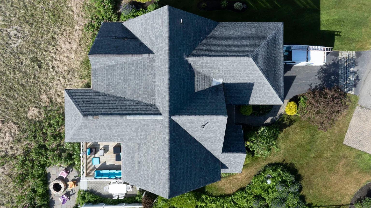
Drone technology also supports practical business applications. Property owners, facility managers, and developers often use aerial imagery to document building conditions, monitor projects, and assist planning. Planned service expansions such as thermal drone imaging for agriculture crop monitoring, building energy audits, drone surveying and mapping, and golf course management will provide additional ways to support businesses with valuable aerial information.
Professional aerial photography requires more than operating a drone. Flight planning, lighting, composition, weather conditions, and image editing all contribute to producing photographs that communicate information clearly while accurately representing the subject.
The right perspective often changes how people see a property. Professional aerial photography in Maine helps communicate details that traditional photography simply cannot capture, making presentations more informative and visually engaging. If you’re considering drone services, a professional drone photographer, or drone photography, Quality Aerials can provide professional aerial imagery that helps your property stand out while giving viewers a clearer understanding of everything it has to offer. Call now.