
When a property is large, complex, or set within a distinctive landscape, ground-level photography tells only part of the story. A camera positioned at eye level captures a wall, a facade, a driveway. It cannot communicate how a 50-acre parcel meets the water, where the access points sit relative to the road, or how a building relates to the land around it. For property owners and real estate professionals across Maine and the greater New England area, aerial photography services are closing that gap in a way no ground-based approach can.
Quality Aerials, based in Falmouth, ME, provides professional aerial photography services across Portland, Brunswick, Windham, Saco, Lewiston, and surrounding communities, giving property owners the visual tools they need to present large and complex properties with the clarity buyers and investors expect.
Scale is one of the hardest things to communicate in a property listing. A sprawling waterfront estate, a rural parcel with multiple structures, or a commercial development site all lose their sense of dimension when photographed from the ground. Aerial photography services capture the full footprint of a property in a single frame, giving viewers an immediate understanding of how much land they are looking at and how it is organized.
According to the National Association of Realtors’ research on drone technology in land and commercial real estate, aerial images deliver a better perspective of land than ground views and maps with limited detail, with real estate investment firms and developers recognizing that drone footage offers significantly more insight into a property’s characteristics and potential than any ground-level alternative.
A property does not exist in isolation. Its value is shaped by what surrounds it, whether that is a lake, a mountain view, proximity to a town center, or adjacency to other land uses. High-resolution aerial photography captures all of that context in a single image, showing potential buyers and investors exactly where the property sits within its environment.
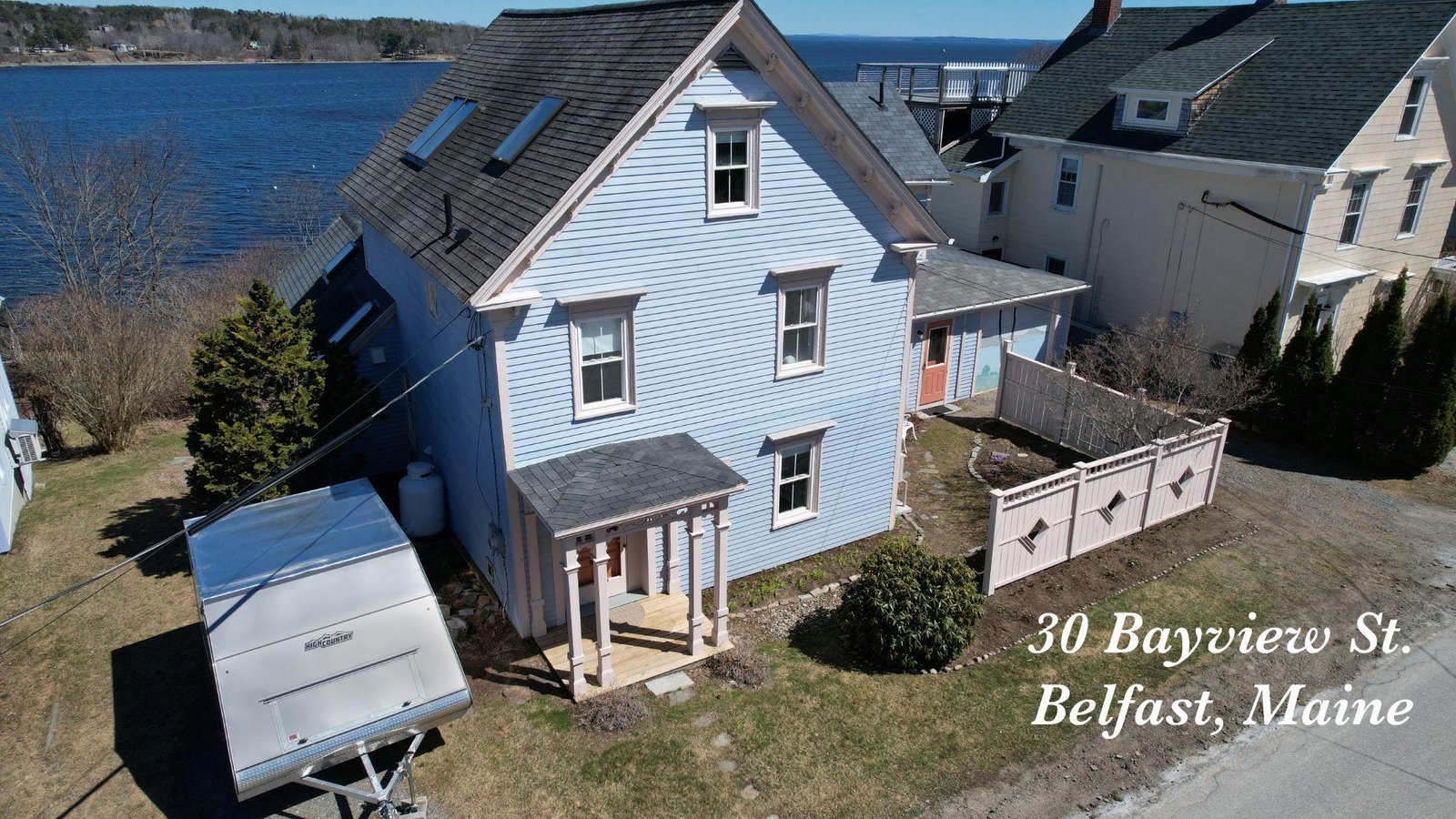
For waterfront properties along Maine’s lakes, rivers, and coastline, this context is everything. An aerial shot communicates the relationship between the structure and the water in a way that a ground photo never can. The same applies to rural parcels where terrain variation, woodland cover, open fields, and drainage features all factor into how a buyer understands what they are purchasing.
Access is a critical consideration for any large property, and it is one of the details most easily missed in ground-level photography. Drone photography reveals driveways, road frontage, easements, cleared paths, and entry points across the entire property in one aerial pass, giving buyers a clear picture of how the land is accessed and navigated.
Land characteristics including slope, drainage patterns, cleared versus wooded areas, and existing infrastructure are all visible from above in ways that require hours of walking to assess on the ground. The NAR’s 2025 REALTOR Technology Survey confirms that drone photography and video are now used by 52 percent of agents, reflecting how widely the industry has recognized the value of aerial imagery for communicating property characteristics that ground photography misses.
The National Association of Realtors’ guide on using drone photography for property listings notes that aerial drone photography is particularly compelling for waterfront properties and homes with dramatic views, highlighting how aerial footage communicates landscape features, surrounding context, and property scale in ways that no ground-level image can replicate, making it an especially powerful tool for large and distinctive properties.
Property owners, real estate professionals, and developers across Maine looking for professional aerial photography services in Maine are encouraged to reach out to Quality Aerials. Our team provides high-resolution aerial photography, drone videography, and expanding specialty services including thermal drone services, drone surveying and mapping, and drone golf course management across Portland, Falmouth, Brunswick, Windham, and greater New England. Contact Quality Aerials to get started.