Land surveying has been a cornerstone of property ownership, construction, and development for centuries. From the early days of theodolites and measuring chains to GPS-assisted total stations, the tools have evolved steadily, but the fundamental process of sending crews into the field to collect ground-level measurements has remained largely unchanged. Today, drone surveying is challenging that model in ways that are hard to overstate, offering a fundamentally different approach to data collection that delivers results traditional methods simply cannot match in speed, coverage, or cost efficiency.
For property owners, land developers, engineers, and construction professionals, understanding the differences between drone-based and traditional surveying is no longer a matter of curiosity. It is increasingly a practical consideration that affects project timelines, budgets, and the quality of the data underpinning every decision on a site.
This blog breaks down how each method works, where each performs best, what the data accuracy looks like in practice, and how drone surveying is reshaping the way construction, land development, and property planning projects get done.
Traditional land surveying involves physical field crews using instruments such as total stations, GPS receivers, theodolites, and levels to collect precise measurements at specific points across a site. Each measurement is taken manually, recorded, and then compiled into a dataset used to produce maps, boundary descriptions, legal documents, and engineering drawings.
For small or clearly defined sites, traditional surveying delivers highly accurate point data. Licensed surveyors bring legal authority to boundary determinations, and their work product is admissible in court proceedings, title transfers, and planning applications. The precision at individual measurement points is excellent, typically within a few millimeters under ideal conditions.
However, traditional surveying has significant limitations when it comes to large or complex sites. A ground crew can only collect so many data points per day. Steep terrain, dense vegetation, bodies of water, and unstable ground all slow the process and create safety risks.
Large sites that require comprehensive topographic mapping can take days or even weeks to complete by ground methods, and the cost scales accordingly. The density of data points collected is also constrained by the speed and reach of a two-person crew on the ground, making high-resolution aerial photography and drone-based data collection an increasingly attractive alternative for site managers and developers.

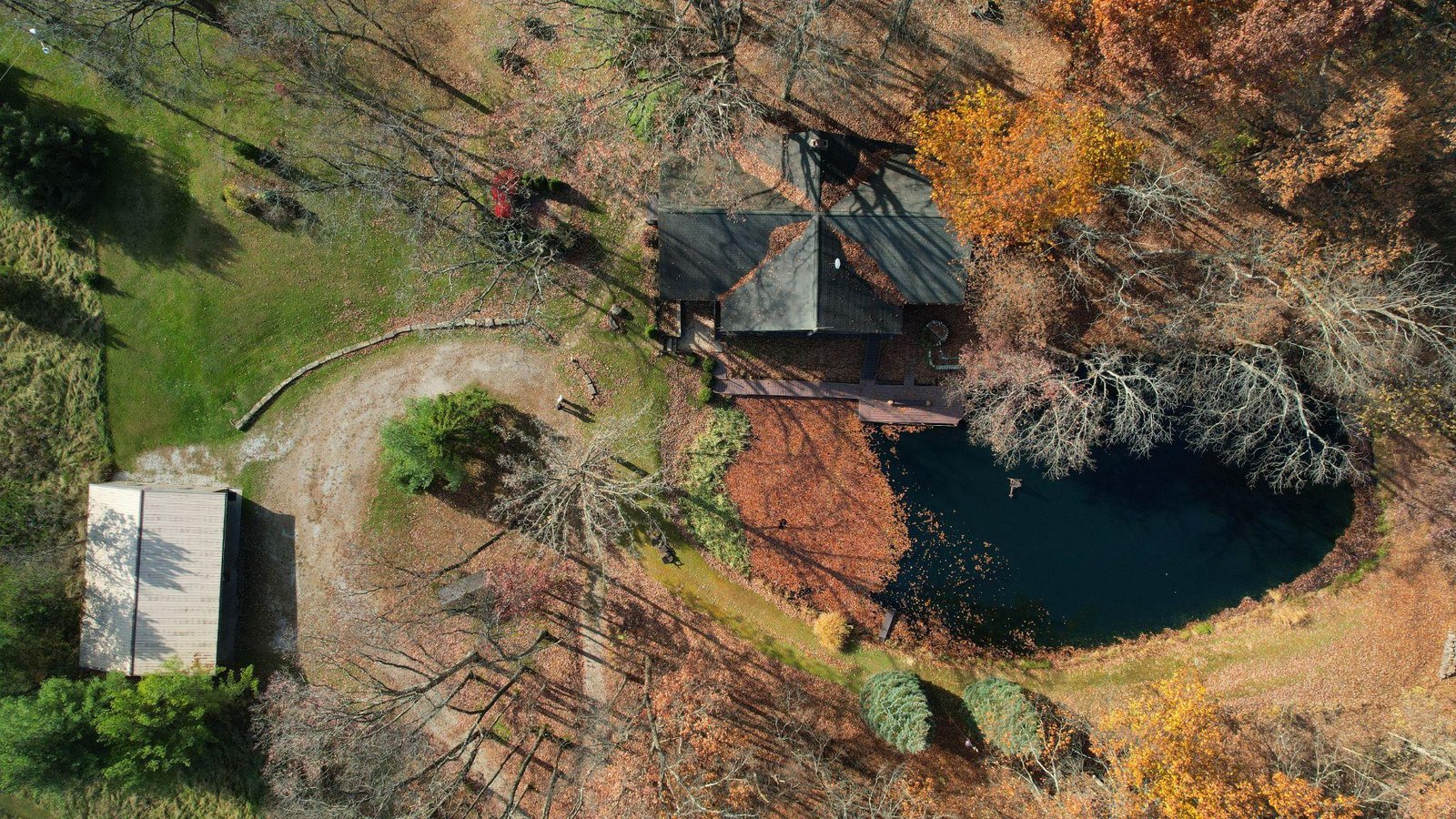
Drone surveying takes a fundamentally different approach. Instead of collecting individual ground-level measurements, a drone equipped with a high-resolution camera and GPS receiver flies a pre-programmed grid pattern over the survey area, capturing hundreds or thousands of overlapping aerial images. Those images are processed using photogrammetry software to produce orthomosaic maps, digital elevation models, 3D point clouds, and volumetric measurements that cover the entire site area rather than a network of individual points.
Washington University in St. Louis describes in their research guide on using drones for photogrammetric surveys how UAV-based surveys produce sequential overlapping aerial photographs that are processed into 3D point clouds, digital terrain models, contour maps, and orthomosaic images, with the accuracy of the final deliverables anchored by ground control points placed at known coordinates across the site.
The result is a spatial dataset of extraordinary density. Where a traditional survey might collect hundreds or a few thousand measurement points across a large site, a drone service produces millions of data points across the same area, creating a continuous surface model rather than a network of discrete measurements. That shift from point-based to surface-based data is one of the most significant practical differences between the two methods, and it is why drone mapping and inspection services are increasingly the first choice for large-scale topographic and development surveys.
Accuracy is the first question most surveyors and developers ask about drone surveying, and the answer has become increasingly compelling as the technology has matured. Research published in the journal Frontiers in Built Environment on comparative drone technology versus traditional surveying methods in volumetric computation found that drone-based surveying delivered volumetric accuracy within the maximum allowable percentage error of plus or minus three percent, with data collection taking 35 minutes compared to 97 minutes for traditional tape-based methods across the same site.
According to the U.S. Geological Survey’s Aerial Imaging and Mapping group, drone-derived maps produced using photogrammetric techniques and ground control points can achieve horizontal resolutions of 5 to 10 centimeters and vertical precision within 8 centimeters, performance that is comparable in quality to LiDAR surveys but produced at a fraction of the cost.
For boundary surveys requiring legal precision at specific property corners, traditional surveying with a licensed drone pilot working alongside a licensed land surveyor still holds the authoritative position, particularly for title work and legal disputes. But for topographic mapping, volumetric calculations, construction site documentation, and site condition assessments across large areas, drone surveying matches or exceeds traditional accuracy at significantly greater data density and speed.
The USGS fact sheet on UAS capabilities for coastal and environmental mapping notes that drone-acquired imagery can be produced at a fraction of the cost of equivalent LiDAR surveys while delivering comparable horizontal and vertical precision, a performance profile that is reshaping expectations across surveying and mapping disciplines.
Speed is where drone surveying creates some of its most dramatic advantages over traditional methods. A drone can cover several hundred acres in a single flight of one to two hours. Processing the data typically takes another few hours to a day depending on site size and deliverable requirements. A comparable topographic survey conducted by a ground crew on a large or complex site could take several days to a week or more, with corresponding increases in labor costs, equipment time, and project delay.
The FAA highlighted in their reporting on how commercial drone operators are transforming surveying and construction that state transportation departments have been saving hundreds of thousands of dollars by using drones to survey highway medians and infrastructure corridors in a fraction of the time traditional crews require, and that drones are producing 3D maps of airport runways in roughly half the time of conventional survey teams.
For private developers and property owners, that speed advantage translates directly into faster project starts, reduced pre-construction costs, and more responsive data collection throughout a project lifecycle. A professional drone photographer and surveying operator can deliver repeat flights for construction monitoring, as-built documentation, or seasonal site condition assessments at a cost and turnaround that traditional survey crews simply cannot match. Affordable drone photography and surveying services are making this level of site documentation accessible to projects of all sizes, not just large commercial developments.
One of the most underappreciated advantages of drone surveying is its ability to collect data from sites that are difficult, hazardous, or impossible for ground crews to access. Steep slopes, wetlands, active construction zones, contaminated land, unstable fill areas, and waterfront parcels all present real risks and logistical challenges for traditional field crews. A drone covers all of these areas from the air without putting anyone in harm’s way.
The Lincoln Institute of Land Policy notes in their research on the drone revolution in land management and mapping that drones are increasingly being used to survey and map properties in situations where ground access is restricted or cost-prohibitive, enabling surveyors and land managers to collect accurate spatial data on parcels that would otherwise require extensive and expensive access negotiations or physical infrastructure just to reach.
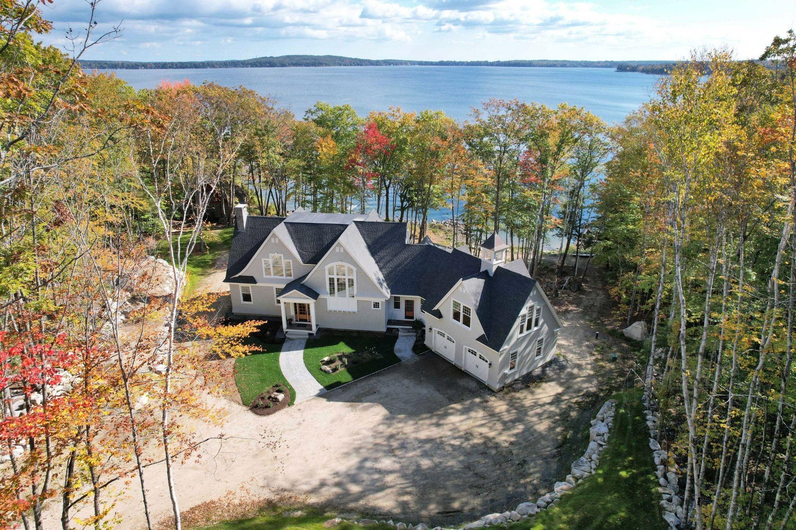
This accessibility advantage also applies to large properties where the sheer scale makes comprehensive ground coverage impractical. Aerial photography services delivered by drone can document every corner of a 500-acre parcel in a single session, producing a complete and current picture of the entire site that no ground crew could match in the same timeframe.
A balanced assessment of drone surveying requires acknowledging where its limitations apply. Legal boundary surveying for title transfers, property disputes, and subdivision plats typically requires the seal of a licensed land surveyor, and in most jurisdictions that seal requires in-person ground verification of boundary corners.
Drones support that process by providing high-resolution context and base mapping, but they do not replace the licensed professional’s legal responsibility for boundary determinations.
Weather and airspace constraints also affect drone operations in ways that traditional surveys are not subject to. High winds, heavy precipitation, restricted airspace near airports, and low visibility all limit when and where drones can fly.
Under FAA Part 107 regulations, an FAA-certified drone operator must operate within defined parameters that include altitude restrictions, daylight requirements, and airspace authorization for controlled zones. These represent real scheduling considerations for time-sensitive projects, though a qualified operator navigates them as a standard part of professional practice.
Dense forest canopy can also limit the accuracy of photogrammetry-based elevation data in heavily wooded areas, since the camera captures the top of the canopy rather than the ground beneath it. In these situations, LiDAR-equipped drones or traditional ground-based methods may be more appropriate for precise terrain modeling beneath heavy tree cover.
Despite those limitations, the range of applications where drone surveying adds measurable value across construction, development, and property planning continues to expand. Pre-construction topographic surveys, site feasibility assessments, grading and earthwork volume calculations, construction progress monitoring, drainage analysis, boundary context mapping, and as-built documentation are all tasks where drone data supports faster, more informed decision-making.
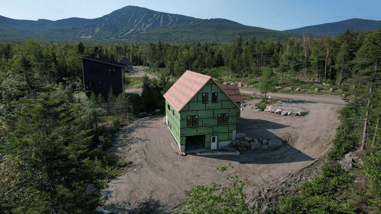
For land developers evaluating a parcel, drone surveying provides a current, high-resolution picture of site conditions, drainage patterns, vegetation cover, existing structures, and terrain variation that supports feasibility analysis before any ground is broken. For construction teams managing an active site, regular drone flights create a documented record of progress that protects against disputes and supports payment applications tied to completed work volumes.
Construction site drone monitoring throughout a project lifecycle gives project managers the aerial perspective needed to track earthmoving quantities, verify that grading matches design intent, identify drainage issues early, and communicate progress to stakeholders with visual clarity that written reports alone cannot provide.
Commercial drone services delivering regular site documentation have become a standard expectation on mid-to-large construction projects, where the cost of a drone flight is a fraction of the cost of a single dispute or rework event.
This same aerial data framework supports broader applications including thermal drone services for building energy audits and drone golf course management, where terrain analysis and drainage mapping deliver the same precision advantages that construction and development teams have come to rely on.

Not all drone surveying is equal. The accuracy of drone-derived data depends on flight planning, camera calibration, the quality and placement of ground control points, and the processing software and expertise applied to the raw imagery. An FAA-certified drone operator working under Part 107 brings the regulatory compliance, equipment quality, and technical workflow needed to produce data that meets engineering and legal standards.
Among the top drone companies, the distinction between a casual operator and a professional surveying provider comes down to methodology, accountability, and deliverable quality. For property owners, developers, and construction teams across New England, working with a qualified local provider who understands regional terrain, weather patterns, and project requirements is the most reliable path to survey data that actually supports confident decision-making.
We at Quality Aerials provide professional drone surveying along with drone mapping and inspection services, aerial photography services, drone inspections, and expanding specialty services including thermal drone services for agriculture and building energy audits, and drone golf course management across Maine, New Hampshire, and the greater New England area. Based in Falmouth, ME, our team brings the local expertise, professional equipment, and technical precision your project requires from the first site assessment to final documentation. Call now.