
Maine’s real estate market stretches from tight coastal peninsulas to wide inland acreage, and no two listings compete in quite the same way. Quality Aerials, based in Falmouth, ME, works with agents across the state who are looking for a marketing edge that goes beyond another round of ground-level photos. For many of them, drone photography services have become one of the most reliable investments in their marketing budget, not because aerial images look impressive, but because they change how quickly and confidently buyers respond to a listing.
Coastal towns near Portland, Falmouth, and the surrounding midcoast draw buyers who compare dozens of waterfront and near-water listings before ever scheduling a showing. Inland and rural areas present a different challenge: acreage, tree lines, and privacy are the selling points, but they are also the hardest features to communicate through a handful of ground-level shots. Agents working either market are competing for the same limited attention span online, and the listings that show the full property, not just the house, tend to hold that attention longer.
Adding to the pressure, Maine’s real estate market includes a large share of out-of-state and second-home buyers who cannot easily drive by a property before deciding whether it is worth pursuing. For these buyers, the online listing is doing almost all of the work that an in-person walk-through would normally do. A listing that fails to communicate scale, setting, and surroundings is asking a remote buyer to take a leap of faith that a competing, better-presented listing does not require.
Buyers form an opinion about a property before they ever request a showing. According to Redfin, homes marketed with strong professional photography consistently see more clicks, longer viewing times, and more showing requests than listings relying on basic images. Aerial imagery extends that same principle. A single wide shot from above can communicate lot size, waterfront access, and surrounding context that would otherwise take several disconnected photos to explain, if it could be explained at all.
This matters more in a market where buyers are scrolling through listings quickly, often on a phone screen, deciding within seconds whether to click in or keep moving. An aerial hero image tends to stop that scroll in a way a straight-on exterior shot rarely does, simply because it shows something the buyer has not already seen a dozen times that afternoon.
For agents unfamiliar with the process, professional drone photography services typically cover more than a few pretty shots from above. A complete package usually includes:
Agents who understand what is included tend to get more value from the investment because they know what to request and how to use it across their marketing, from the MLS listing itself to social media, print flyers, and email campaigns.
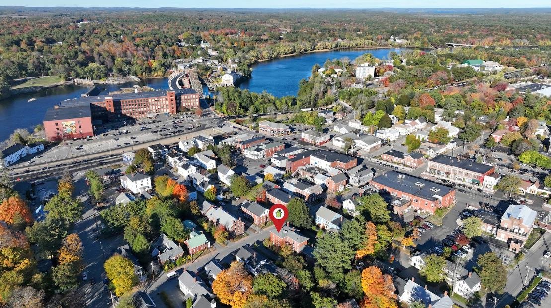
Waterfront and near-water properties are some of the most competitive listings in Maine, and they are also the ones aerial imagery benefits most. Real estate drone photography in Maine can show shoreline access, dock placement, and the relationship between a home and the water in a single frame. Buyers relocating from out of state, who make up a meaningful share of Maine’s coastal market, often rely heavily on these images to judge a property before booking travel to see it in person.
Coastal listings also tend to compete on lifestyle as much as square footage. An aerial image that captures a private dock, a stretch of shoreline, or a view down the coastline sells the experience of owning the property, not just the structure sitting on it. From Portland and South Portland out toward Scarborough and Biddeford, coastal inventory moves quickly when it is marketed well, and slowly when it isn’t.
Rural properties face the opposite challenge. Acreage, fields, and privacy are difficult to sell with interior photos alone. High-resolution aerial photography in Maine gives buyers a sense of scale that a written description cannot fully replace. Showing how a home sits relative to its land, tree cover, and neighboring properties helps serious buyers understand a rural listing before deciding whether it is worth the drive to see it.
For farms, hobby properties, and larger inland parcels, an aerial view can also help buyers picture how the land could be used, whether that means separating a pasture, identifying a building site, or simply understanding how much privacy the property actually offers from its nearest neighbors.
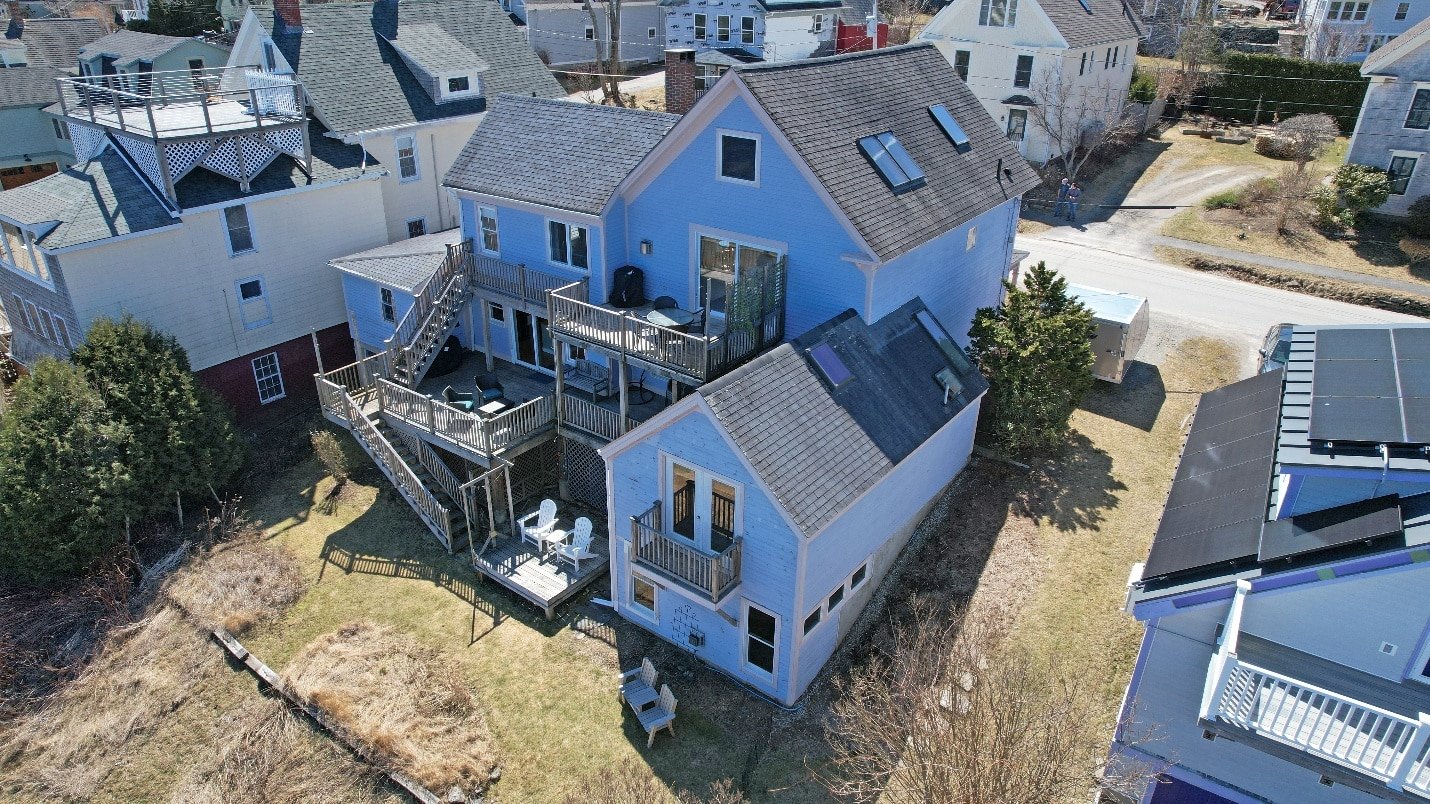
One of the more practical benefits of drone photography for agents is fewer unproductive showings. When buyers can see a property’s full context online, including its land, surroundings, and access points, they are better equipped to decide whether a showing is worth scheduling. This filtering effect matters in both directions: buyers spend less time on properties that do not fit their needs, and agents spend less time hosting showings that were never going to lead anywhere.
Fewer wasted showings also means agents can dedicate more attention to serious buyers, which tends to shorten the overall path from listing to closing.
Photography captures a single perspective, but real estate aerial video tours in Maine can give buyers a sense of movement and flow that stills cannot. Video works especially well for larger properties, waterfront estates, and listings where the surrounding land is as much a selling point as the structure. Many agents use short aerial video clips specifically for social media, where movement tends to hold attention longer than a static image, and where a well-edited clip can be repurposed across several platforms from a single flight.
It is worth considering what happens when a competing listing includes aerial photography and yours does not. Buyers comparing similar properties side by side will naturally gravitate toward the listing that shows more, explains more, and looks more professionally presented. Skipping aerial imagery does not just mean a less impressive gallery; it can mean a slower sale, more repeated questions from buyers, and a listing that quietly underperforms against its competition without ever giving the seller a clear reason why.
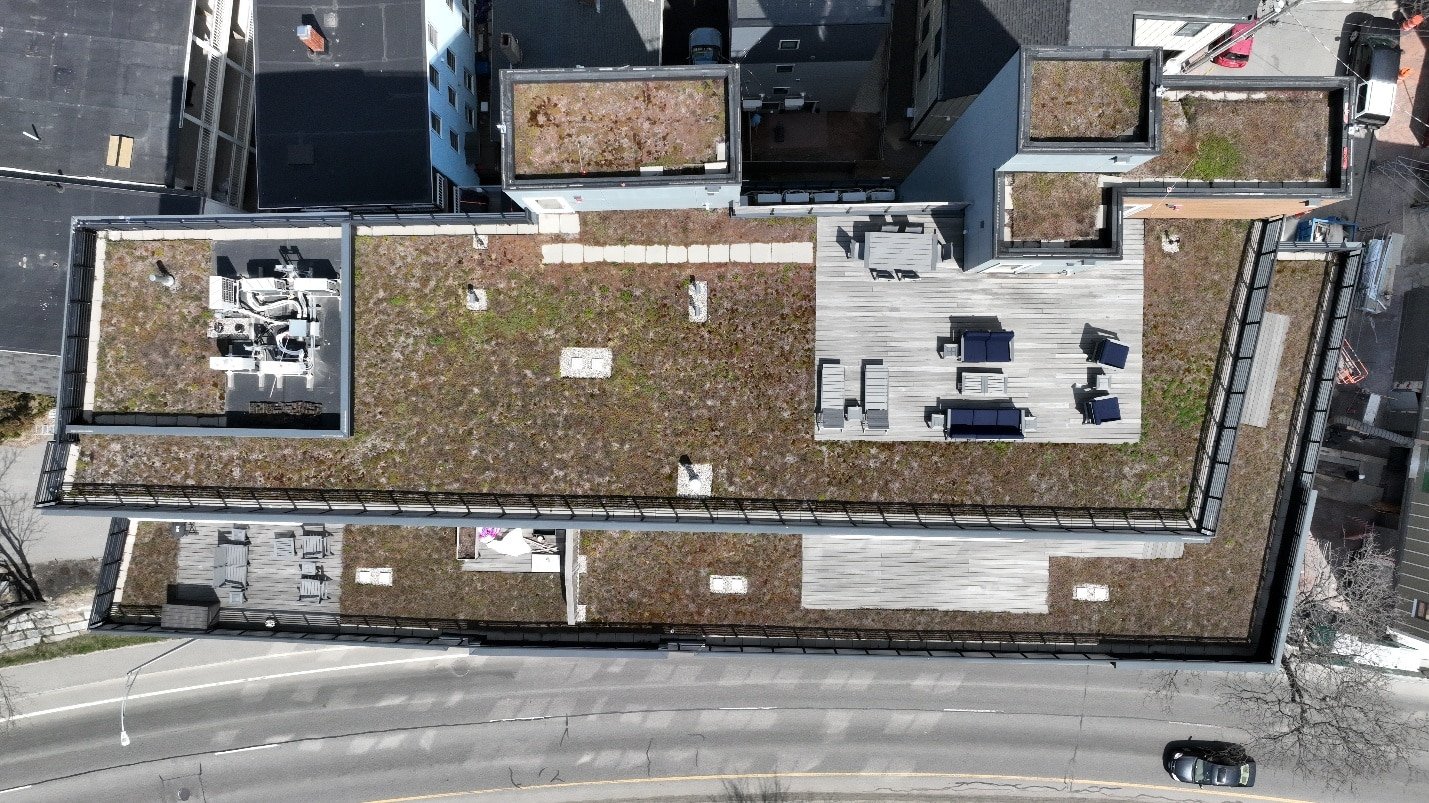
Not every drone operator delivers consistent, professional results, and agents take on some risk by working with someone unlicensed. Commercial drone photography is required by the FAA to be operated under a Remote Pilot Certificate, including work used in real estate marketing. Working with a licensed drone pilot, and specifically an FAA-certified drone operator in Maine, protects agents from liability issues while also ensuring the final images meet a professional standard that reflects well on their listings.
This matters just as much for the agent’s own reputation. A poorly composed or improperly flown shot can make an otherwise strong listing look amateurish, and buyers tend to associate that impression with the agent as much as the property itself.
Not every listing needs the same level of coverage. Drone photography packages in Maine typically range from a handful of still images for a standard listing to full photo-and-video packages for luxury or waterfront properties. Agents who search for the best drone photography in Maine usually compare more than price; turnaround time, editing quality, and the ability to work around Maine’s variable weather all factor into which service actually delivers consistent results across a full season of listings.
Building a relationship with one professional drone photographer in Maine, rather than shopping around for every individual listing, also tends to produce more consistent results. A photographer familiar with an agent’s style and typical property types can move faster and needs less direction on each new project.
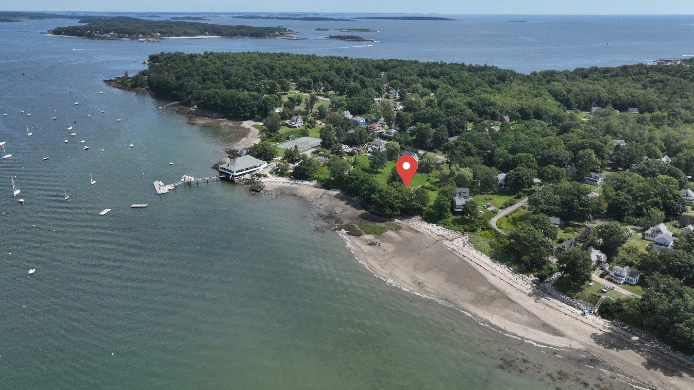
A significant portion of Maine’s real estate activity involves second homes, seasonal properties, and vacation rentals rather than primary residences. Buyers shopping for a summer home, or evaluating a property’s potential as an Airbnb or VRBO rental, are often making decisions from out of state with limited time on the ground. Aerial imagery that clearly shows proximity to water, privacy from neighbors, and the overall setting of the property gives these buyers the confidence to move forward without multiple in-person visits.
Maine’s weather adds a layer of planning that agents in more temperate markets rarely think about. Fall foliage, winter snow cover, and summer’s long daylight hours each change how a property photographs, and a good drone operator plans around these shifts rather than working around them after the fact. Scheduling a flight during the right season, or even the right week, can be the difference between images that showcase a property at its best and ones that need to be reshot before a listing goes live.
Agents who plan aerial photography early in their listing timeline, rather than as a last-minute addition, tend to have more flexibility to work around Maine’s weather rather than being at its mercy.
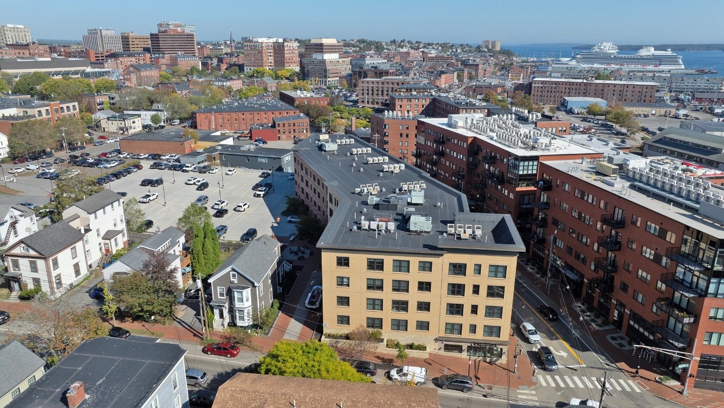
Residential sales are not the only part of an agent’s business that benefits from aerial imagery. Agents who also handle commercial properties, multi-unit buildings, or land for future development rely on commercial drone services in Maine to show parking, access routes, and surrounding infrastructure that matter to investors and business buyers. The same principles that help a residential listing stand out, showing more context in less time, apply just as directly to commercial and investment properties.
Beyond any single listing, consistent aerial imagery contributes to how an agent is perceived over time. Agents who search for top drone companies in Maine are often looking for more than a one-time service; they want a consistent visual style they can rely on across every listing, season after season. That consistency becomes part of an agent’s personal brand, signaling to sellers that their property will be marketed at a professional standard from the very first photo.
Aerial imagery is increasingly used for more than marketing a single listing. Some agents use drone footage to document a property’s condition before listing it, or to create content for their own personal branding beyond individual sales. As drone services continue to expand into areas like mapping and site documentation, agents who already have a working relationship with a professional drone photographer in Maine are better positioned to take advantage of these tools as they become available.
Aerial imagery has moved from a nice-to-have to a genuine competitive advantage in Maine’s real estate market, whether the listing sits on the coast or well inland. Agents who invest in drone photography services consistently give their listings a stronger first impression, more engagement, and a clearer path to a faster sale, without having to change anything about the property itself.
Quality Aerials, based in Falmouth, ME, works with agents throughout Maine, from coastal Portland to rural inland communities, who are ready to give their next listing the presentation it deserves. Whether the need is a single high-resolution image or a full aerial video tour, reach out today to discuss a drone photography package built around your listing calendar.