
Drone technology has changed significantly over the past decade. Once viewed primarily as a way to capture impressive aerial photographs, drones now support businesses across many industries by providing practical information that improves planning, communication, inspections, and decision-making. Modern drone solutions help organizations complete tasks more efficiently while gathering valuable visual data from perspectives that are difficult to achieve from the ground.
Many businesses first become familiar with drone services in Maine through photography projects, but today’s applications extend far beyond marketing. Real estate professionals, construction companies, property managers, farmers, engineers, and recreational facilities are increasingly using drones to solve everyday operational challenges.
Property marketing has always depended on strong visual presentation.
Traditional photography remains an important part of showcasing homes and commercial buildings, but aerial imagery provides additional context that ground-level photographs cannot always communicate.
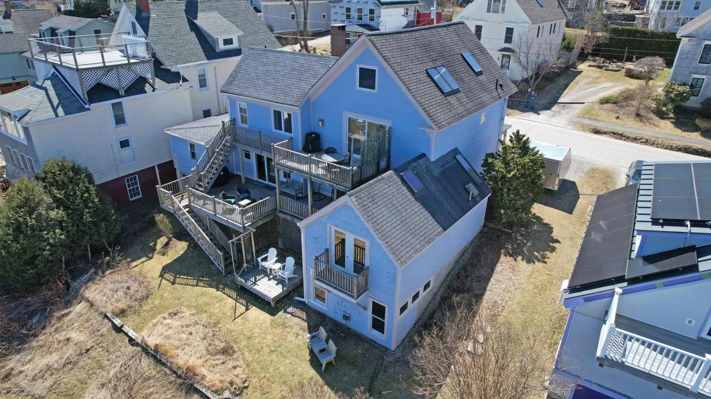
Drone photography helps potential buyers understand property boundaries, outdoor spaces, nearby roads, parking areas, surrounding amenities, and the relationship between buildings.
Instead of relying on multiple disconnected photographs, viewers receive a complete overview that creates a clearer understanding of the property before scheduling a visit.
Many agents also combine aerial photography with real estate aerial video tours, allowing buyers to experience smooth overhead views that demonstrate the property’s setting more naturally. These visual tools often improve online engagement while helping buyers make better-informed decisions.
Commercial buildings frequently include features that are difficult to appreciate from eye level alone.
Customer parking, loading areas, warehouse facilities, access roads, storage yards, and neighboring businesses all influence how a property functions.
Aerial imagery allows business owners, investors, and prospective tenants to evaluate these features more effectively.
Professional drone photography also supports promotional material for shopping centers, office developments, hotels, industrial facilities, and tourism businesses by presenting the complete site in an organized manner.
Businesses using commercial drone services often benefit from imagery that works across websites, brochures, presentations, advertising campaigns, and social media.
Construction sites change rapidly.
Keeping accurate visual records helps contractors, developers, project managers, and investors monitor progress throughout every stage of development.
Drone photography provides repeatable viewpoints that allow projects to be documented consistently over time.
Foundation work, framing, roofing, exterior finishes, equipment positioning, and completed phases can all be recorded from the same aerial locations during each visit.
Many organizations rely on construction site drone monitoring because it creates organized progress reports that support communication between stakeholders while reducing the need for frequent site visits.
These records also become valuable references after projects have been completed.
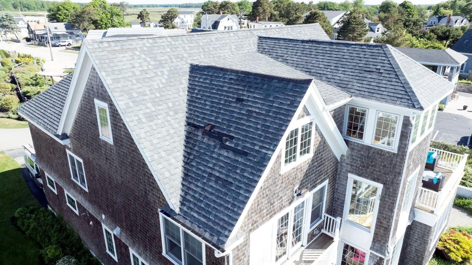
Inspecting roofs, commercial buildings, communication towers, and industrial facilities traditionally required ladders, scaffolding, or specialized access equipment.
Drone technology now provides a practical alternative for many visual inspections. High-resolution aerial photographs help property owners review elevated structures without unnecessary physical access during initial assessments.
This improves efficiency while reducing disruption to normal business operations.
Many organizations schedule regular drone inspection services to monitor property conditions over time. Likewise, drone roof inspection services allow detailed visual reviews of roofing systems before repairs or maintenance begin.
Photographic records can also be stored for future comparison, helping owners identify visible changes more easily.
Drone technology is becoming increasingly valuable for surveying and mapping projects. Large development sites, agricultural properties, construction projects, and commercial land often require accurate visual information before planning decisions can be made. Drone surveying and mapping provide efficient aerial data that supports engineers, developers, planners, and land managers. By documenting site conditions from above, businesses gain a clearer understanding of property layouts, access routes, boundaries, and existing features.
As these services continue expanding, organizations will have additional ways to gather dependable information while reducing the time required for traditional site documentation. Aerial mapping can also improve communication between project teams by providing consistent visual references throughout planning and development. Having current site imagery available allows discussions to be based on accurate information, helping projects move forward with greater confidence and efficiency.
Agriculture continues adopting drone technology for practical field management. Planned thermal drone services for crop monitoring will provide farmers with additional information that may help identify visible variations across growing areas more efficiently than ground inspections alone.
Instead of walking large fields repeatedly, aerial imagery can provide broader coverage within a shorter period. These developing agricultural drone services demonstrate how drone technology supports practical decision-making while improving overall observation of agricultural operations.
As thermal imaging capabilities continue expanding, farmers will have access to additional aerial information that supports ongoing crop management.
Buildings often lose energy through areas that remain difficult to identify during routine visual inspections.
Planned thermal drone services for building energy audits will provide another practical application for aerial technology.
Thermal imaging allows visible temperature differences to be recorded from above, helping identify areas that may benefit from further investigation.
Commercial buildings, public facilities, industrial properties, and large residential developments may all benefit from this additional information when planning maintenance or energy efficiency improvements.
Rather than replacing traditional assessments, aerial thermal imaging provides another useful source of visual information that supports property management decisions.
The growing range of drone applications demonstrates that aerial technology is no longer limited to photography alone.
Businesses increasingly rely on drones to improve communication, document progress, assist inspections, support planning, and gather visual information that contributes to everyday operations.
As new services continue becoming available, organizations across multiple industries are finding practical ways to integrate drone technology into their existing workflows, improving efficiency while creating valuable records that support future decision-making.
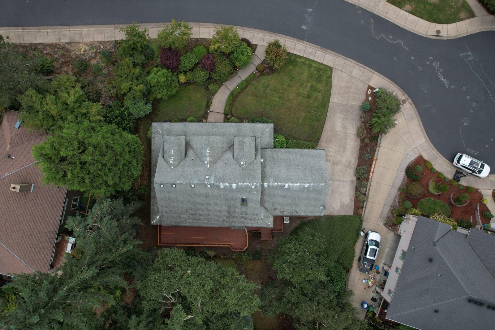
As businesses continue adopting aerial technology, the focus is shifting from simply collecting images to making better operational decisions. Reliable visual information supports planning meetings, maintenance schedules, and project coordination across multiple departments. Clear aerial data helps teams communicate more effectively, identify visible site changes, and document conditions with greater consistency.
Property managers can compare inspection records over time, developers can monitor project milestones, and business owners can maintain accurate visual documentation for planning and reporting. These records also provide useful references when discussing future improvements or reviewing completed work.
With expanding capabilities such as thermal imaging, surveying, mapping, and specialized industry applications, drone technology continues providing practical solutions that save time, improve communication, and support informed decision-making across a wide range of commercial sectors. This flexibility allows organizations to adapt aerial services to changing operational needs as technology continues advancing.
Golf courses require regular attention across large outdoor areas that can be difficult to assess from ground level alone.
Planned drone services for golf course management will provide course operators with detailed aerial views of fairways, greens, bunkers, water features, cart paths, and surrounding facilities. These images can support maintenance planning, project discussions, and promotional activities while creating organized visual records of the entire property.
Aerial photography also allows golf clubs to present their facilities more effectively to prospective members, tournament organizers, and visitors. Instead of relying on individual ground photographs, complete overhead views help communicate the course layout and overall appearance.
As these services become available, golf facilities will gain another practical way to use aerial technology beyond traditional marketing.
Although drones now serve many technical purposes, marketing remains one of their most valuable applications.
Businesses across numerous industries benefit from professional aerial imagery because it immediately provides viewers with a broader understanding of a property, facility, or event.
Hotels can present accommodation alongside nearby attractions. Retail centers can highlight customer access and parking. Industrial businesses can showcase operational scale, while tourism operators can present destinations from distinctive viewpoints.
Many organizations also combine photography with drone marketing videos to create engaging visual content for websites, presentations, social media, and advertising campaigns.
Rather than simply attracting attention, these visuals communicate useful information that helps potential customers better understand what the business offers.
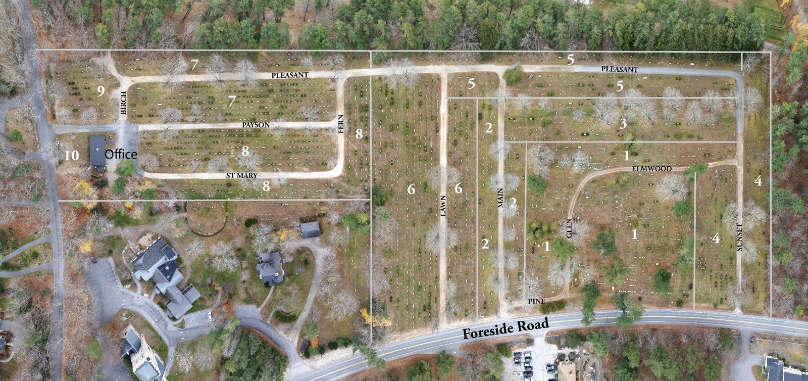
One of the greatest advantages of professional drone services is the ability to communicate information clearly.
People process visual content quickly. Well-planned aerial imagery helps clients, investors, customers, and stakeholders understand property layouts, project progress, surrounding areas, and operational facilities without relying solely on written descriptions.
This improved understanding often leads to more productive conversations because important details are already visible within the photographs or videos.
Aerial imagery provides practical information that supports informed decision-making whether documenting construction, presenting commercial property, supporting inspections, or monitoring agricultural operations.
Successful drone projects begin long before the aircraft leaves the ground.
Professional operators review weather conditions, airspace requirements, lighting, safety considerations, flight paths, and project objectives before every assignment.
This preparation helps ensure that each flight produces useful results rather than simply collecting large numbers of photographs.
Image selection, editing, and organized delivery are equally important.
Instead of supplying every photograph captured during a flight, experienced professionals provide carefully selected images that best communicate the client’s objectives.
This organized approach saves time while creating a stronger final presentation.
Businesses should expect drone operators to maintain high professional standards throughout every project.
That includes following aviation regulations, operating responsibly around people and property, communicating clearly with clients, and delivering imagery that accurately represents the subject.
Working with a licensed drone pilot provides confidence that flights are completed responsibly while maintaining recognized operational standards.
Many commercial organizations also prefer an FAA-certified drone operator, particularly for projects involving inspections, commercial developments, or ongoing documentation where consistency and professionalism are essential.
Choosing experienced operators helps businesses receive imagery that supports both immediate objectives and future planning.
Many organizations schedule drone services regularly rather than as one-time projects.
Construction companies document every stage of development. Property managers maintain updated inspection records. Commercial businesses refresh marketing materials, while agricultural operations monitor seasonal changes.
Over time, these projects create a valuable visual archive that supports reporting, maintenance planning, investment discussions, and future marketing.
Having organized aerial records also makes it easier to compare changes across months and years, providing businesses with reliable reference material whenever needed.
This long-term value is one reason drone technology continues to become an important business resource across many industries.
Modern drone solutions provide far more than impressive aerial photography. From real estate marketing and construction monitoring to thermal imaging, surveying, mapping, crop observation, building assessments, and planned golf course management services, drones continue helping businesses solve practical challenges with greater efficiency and clearer visual information. As technology advances, these applications will continue creating new opportunities across a wide range of industries.
If you’re looking for drone mapping and inspection services, or commercial drone services in Maine, Quality Aerials delivers professional aerial services designed to support your business with reliable imagery and practical solutions. Reach out to our team today to discuss how drone technology can help meet your project goals. Call now.