
First impressions often begin online, whether someone is searching for a new home, a commercial building, a holiday rental, or development land. A single photograph can influence whether a person keeps scrolling or decides to learn more. While traditional ground-level images remain valuable, they cannot always communicate the full character of a property.
Professional drone photography services provide a broader viewpoint that helps viewers understand size, surroundings, access, and layout in ways standard photography cannot. For many property owners, using drone photography adds visual context that supports better decisions and stronger engagement.
People naturally process visual information quickly. When photographs only show individual rooms or isolated exterior angles, viewers are left filling gaps with assumptions. Those assumptions may not always be accurate.
Aerial photography presents the complete setting from above. Instead of seeing only a front entrance or a backyard, viewers gain a clearer understanding of how everything connects. They can identify outdoor amenities, surrounding roads, parking areas, neighboring properties, natural features, and overall proportions within seconds.
This wider perspective creates confidence because fewer details remain hidden. Buyers, investors, tenants, and clients appreciate having a more complete visual representation before scheduling a visit.
One of the biggest challenges with conventional photography is representing scale. Wide-angle lenses can sometimes exaggerate room sizes, while close-up exterior images may unintentionally make lots appear smaller than they actually are.
Drone imagery provides context by showing the entire property within its surroundings. This allows viewers to better understand:
Rather than relying solely on written descriptions, people can immediately see how much space is available.
For larger residential estates, commercial facilities, farms, industrial sites, and waterfront properties, this broader view becomes even more valuable.
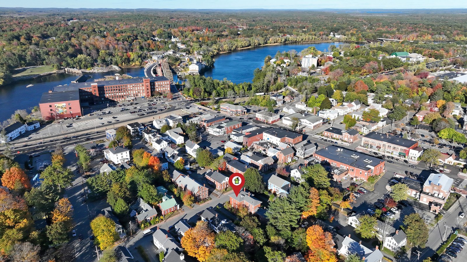
Many valuable property features simply cannot be appreciated from eye level.
Swimming pools hidden behind fencing, extensive gardens, detached garages, landscaped pathways, outdoor kitchens, waterfront access, woodland borders, or large patios often remain partially concealed in standard photographs.
Drone photography captures these features in a single frame without requiring multiple disconnected images.
This creates a stronger visual story by showing how each outdoor element contributes to the property’s overall appeal.
Potential buyers no longer need to mentally piece together separate photographs because the aerial perspective provides a complete overview.
A property is never viewed in isolation.
Its location often influences purchasing decisions just as much as the building itself.
Aerial photography can present nearby amenities without overwhelming viewers. Images may include nearby parks, schools, marinas, walking trails, shopping districts, coastline, wooded areas, or transportation links depending on the property’s setting.
This additional context helps people answer practical questions such as:
Providing these answers visually often creates greater confidence before an in-person viewing.
Real estate professionals constantly compete for attention across property websites and social media platforms.
Listings that include professionally captured aerial imagery frequently stand out because they immediately provide something different from standard galleries.
Rather than beginning with interior photographs alone, an aerial image introduces the entire property first, helping viewers understand its layout before moving inside.
This creates a logical viewing experience that mirrors how people naturally assess a location.
Many successful marketing campaigns combine:
Each format contributes something unique, resulting in a stronger overall presentation.
Using real estate drone photography appropriately within marketing materials helps create visual consistency while giving prospective buyers a clearer understanding of the property.
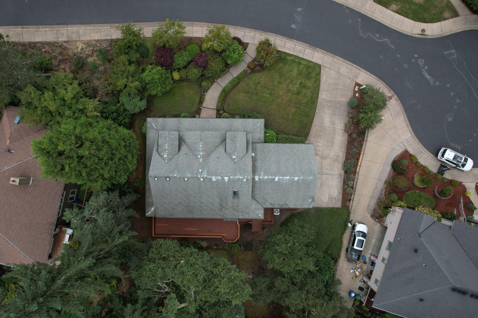
Drone imagery is not limited to residential listings.
Commercial buildings often contain features that are difficult to communicate using traditional photography.
These may include:
Aerial photography helps investors, tenants, and business owners evaluate whether a property meets their operational requirements before arranging a site visit.
This additional perspective supports more informed decision-making throughout the commercial property process.
Construction projects change continuously.
Photographing progress from the ground often produces inconsistent viewpoints, making comparisons difficult over time.
Drone imagery allows similar viewpoints to be repeated throughout a project’s duration.
This consistency helps document:
Many organizations also benefit from construction site drone monitoring because regular aerial documentation provides useful progress records for stakeholders, contractors, and clients.
Beyond marketing completed developments, these images create an organized historical record from beginning to completion.
Certain properties simply cannot be represented fully from ground level.
Waterfront homes may include private docks, shoreline access, boat storage, or surrounding water views that become much clearer from above.
Likewise, rural properties often contain acreage, fields, barns, forests, ponds, private roads, or agricultural buildings spread across significant distances.
Attempting to photograph these individually often results in disconnected images that fail to communicate the property’s overall character.
Aerial photography solves this problem by presenting everything within one cohesive visual frame.
This allows viewers to understand the relationship between buildings, natural features, and open spaces much more easily.
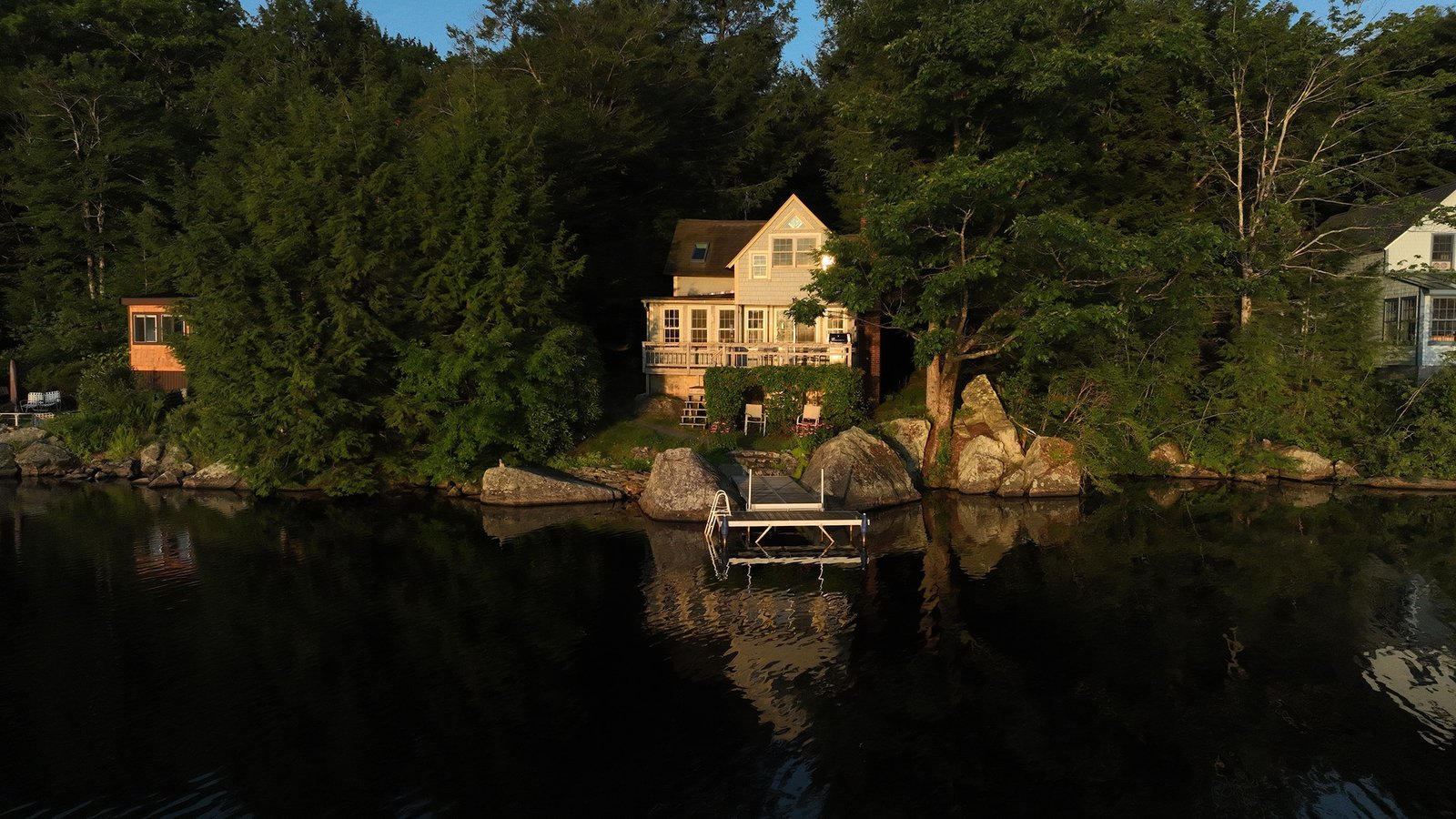
Digital audiences typically spend only a short time evaluating online listings.
Strong visual content encourages people to pause, look closer, and continue browsing additional photographs.
An engaging aerial image often becomes the opening photograph because it immediately communicates information that several ground-level photographs cannot.
When viewers gain a better understanding of the property early, they are more likely to remain engaged throughout the full gallery.
This improved engagement benefits estate agents, developers, hospitality businesses, tourism operators, commercial property owners, and private sellers alike.
The combination of clarity, context, and professional presentation helps properties make stronger first impressions before anyone schedules a visit.
Aerial imagery has value long after a property listing goes live. High-quality photographs can be reused across websites, brochures, advertisements, email campaigns, and social media content, providing consistent visuals that strengthen marketing efforts.
Businesses promoting office developments, hotels, resorts, event venues, holiday rentals, and retail centers can all benefit from showing the full property instead of relying only on close-up images. Aerial content gives potential visitors a better understanding of entrances, parking areas, outdoor facilities, and nearby attractions before they arrive.
Professional imagery also helps establish credibility. Well-planned aerial photographs demonstrate attention to detail and create a polished presentation that reflects positively on the property itself.
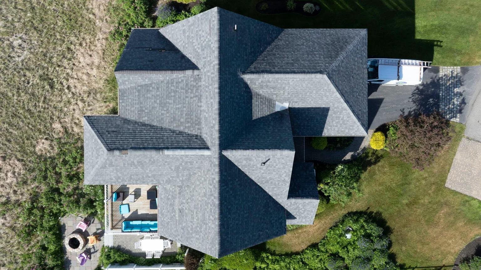
People appreciate seeing what they are considering before making enquiries.
When aerial photographs accurately represent a property’s setting, buyers feel better informed. They are less likely to arrive with unrealistic expectations because they have already seen the property’s layout, surrounding environment, and overall scale.
This transparency can also improve communication between sellers, estate agents, and prospective buyers. Rather than answering repeated questions about outdoor space, access routes, or neighboring properties, many of those answers are already visible within professionally captured images.
Clear visuals save time while helping viewers make decisions based on realistic expectations instead of assumptions.
Drone technology serves purposes beyond marketing. Property owners increasingly use aerial imaging to review building conditions without requiring extensive access equipment.
Roofs, chimneys, gutters, solar panels, and other elevated structures can often be photographed safely from above, providing detailed visual records for maintenance planning.
Many organizations also rely on drone roof inspection services to document hard-to-reach areas before repairs or renovations begin. These images can assist contractors, property managers, and owners by providing an accurate overview of visible conditions.
Similarly, drone mapping and inspection services support planning for larger sites by producing organized visual information that assists with maintenance scheduling and site management.
As drone technology continues developing, additional applications are becoming available. Planned services such as thermal drone imaging for agricultural crop monitoring and building energy audits will provide further ways to identify areas requiring attention through detailed aerial data.
People remember stories more easily than isolated facts.
A carefully planned collection of aerial and ground-level photographs creates a natural sequence that helps viewers understand how a property fits together.
For example, the presentation might begin with a wide aerial image showing the complete site. Additional photographs can gradually move closer, highlighting outdoor amenities before transitioning inside the building.
This logical flow allows viewers to develop a better understanding of the property without feeling overwhelmed by disconnected images.
Adding short aerial video clips can strengthen that experience even further by demonstrating movement, access routes, surrounding features, and overall property layout.
When combined thoughtfully, still photography and video create a presentation that feels informative, organized, and engaging.
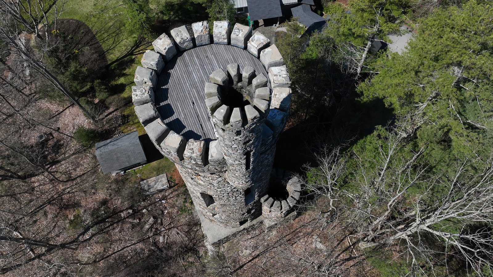
Capturing impressive aerial images requires much more than simply flying a drone.
Weather conditions, lighting, camera settings, flight planning, composition, and aviation regulations all influence the final result.
Experienced operators understand how to position the aircraft safely while selecting angles that present each property honestly and attractively.
They also know how changing sunlight throughout the day affects shadows, reflections, colors, and visibility.
Working with a licensed drone pilot helps ensure flights are conducted responsibly while producing professional-quality imagery that reflects the property’s best features.
Many clients also value working with an FAA-certified drone operator, knowing that regulatory requirements and operational standards are taken seriously throughout every project.
Drone technology continues creating new opportunities across many industries beyond property marketing.
In addition to photography and videography, aerial systems are increasingly supporting mapping, planning, inspections, monitoring, agriculture, and environmental analysis.
Surveying and mapping services are becoming valuable tools for developers, engineers, and land managers seeking accurate site information before projects begin.
Golf course management is another growing application, where aerial imagery can assist with planning, maintenance observations, and overall course documentation.
These expanding capabilities demonstrate that drones are becoming practical business tools as well as creative imaging platforms.
As technology advances, property owners can expect even more efficient methods for documenting, maintaining, and presenting their buildings and surrounding sites.
The way people view a property often influences whether they choose to learn more. Professional aerial imagery provides context that traditional photography alone cannot achieve, helping viewers understand size, surroundings, access, and distinctive features with greater clarity. Whether supporting residential sales, commercial marketing, inspections, or future planning, drone photography services continue to provide meaningful value through accurate visual presentation.
If you’re looking for aerial photography services, drone services, or an FAA-certified drone operator in Maine, Quality Aerials is ready to help present your property from a perspective that leaves a lasting impression. Reach out today to discuss your project and learn how professional aerial imagery can help people see your property in an entirely new way. Call now.