Drone inspections have revolutionized how real estate professionals approach property assessments. With the ability to capture high-resolution aerial photographs from above, drones offer a safer, more efficient way to inspect roofs, chimneys, and hard-to-reach areas. Real estate professionals no longer need to rely on slow, costly manual methods like scaffolding or cherry pickers, which can waste time and money.
Drone inspections reduce property inspection times from days to hours, while also cutting costs by up to 70% compared to traditional methods. In this blog, we will explore how drones provide faster, more accurate inspections, eliminate dangerous safety risks, and deliver cost-saving benefits for real estate professionals in Maine. Quality Aerials, with 800+ flights under its belt, offers 24-48 hour reports at half the cost of national competitors, making it the smart choice for local real estate professionals.
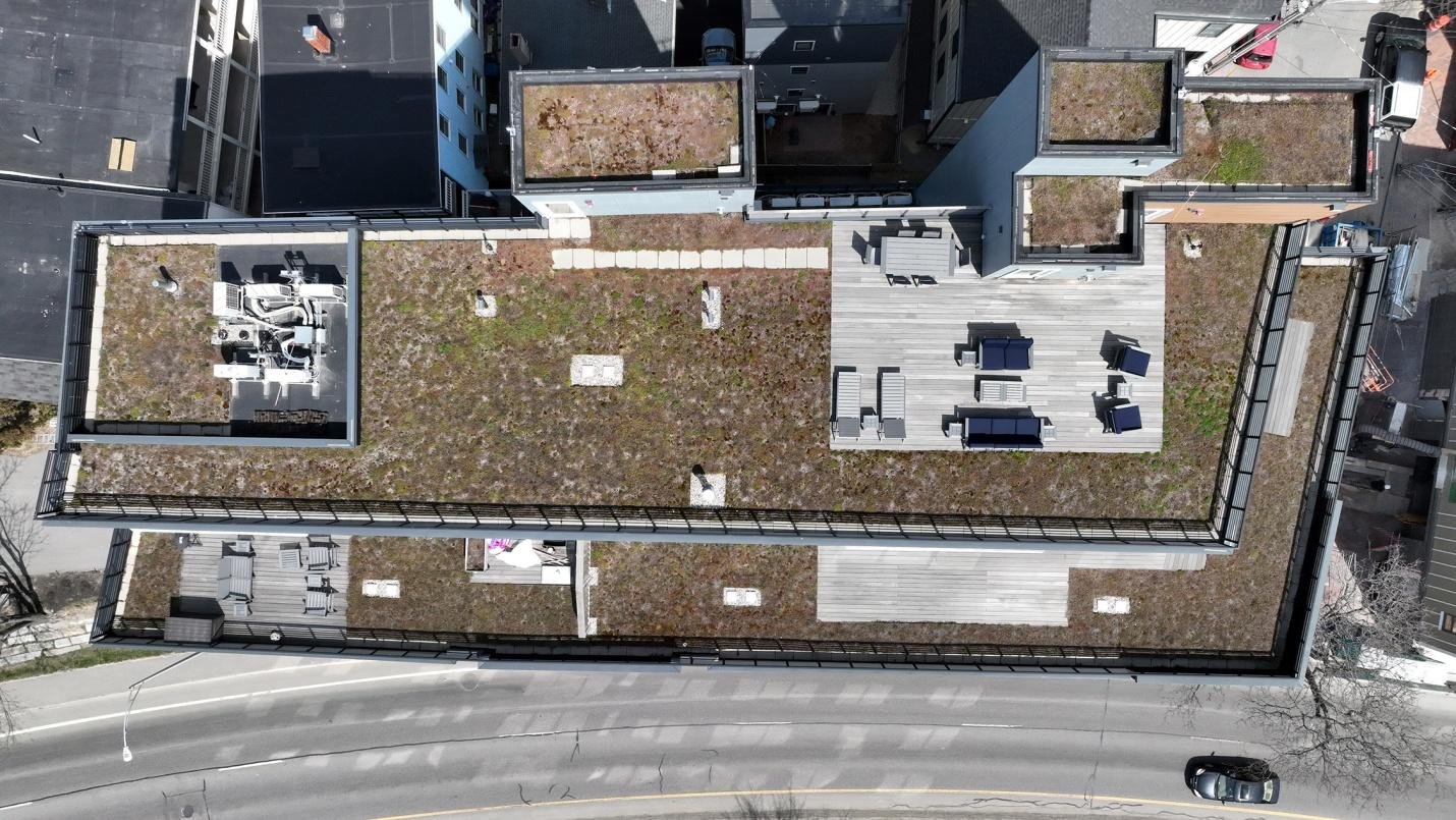
Drones cut the time needed for exterior inspections dramatically, completing them in just 20-30 minutes, compared to the 4-8 hours required for manual methods. Traditional inspections require setup delays for equipment like lifts and ladders, coordination with traffic or weather, and multiple workers to complete the task. These inefficiencies add hours to the inspection process, especially when dealing with multiple properties.
For example, a team might spend 4-8 hours per property when using traditional inspection methods, which adds up quickly. If inspecting 10 properties, that means 40-80 total hours of labor. On the other hand, drone inspection services can complete the same 10 properties in just 3-5 hours.
In Maine’s unpredictable weather, drones can operate safely under cloud cover, where lifts would otherwise be grounded. This allows for same-day reporting, helping realtors to close deals faster.
Step-by-Step Drone Workflow:
For instance, a Portland condo complex was inspected in 25 minutes using drone services, allowing for a listing launch that same week.
When using manual inspection methods, costs can easily exceed $1,500-$5,000 per property, including equipment rental, labor, and insurance premiums. For example, lift rentals cost $800 per day, and typically, 2-3 workers are required at $50 per hour.
In contrast, drone inspection services significantly lower these costs. Drone inspections typically range from $300-$800, eliminating the need for equipment rentals, multi-person crews, and high insurance premiums.
For larger-scale operations, these savings multiply. If a real estate company inspects 50 properties per year, manual inspection costs could total $125,000 annually, while drone services would keep costs to just $25,000, saving a substantial $100,000. For 200 properties, savings increase to $400,000 annually.
Additional hidden savings come from:
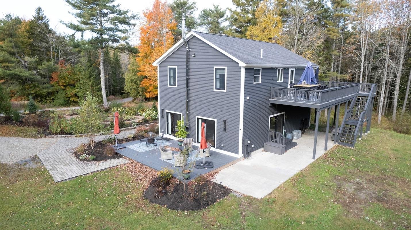
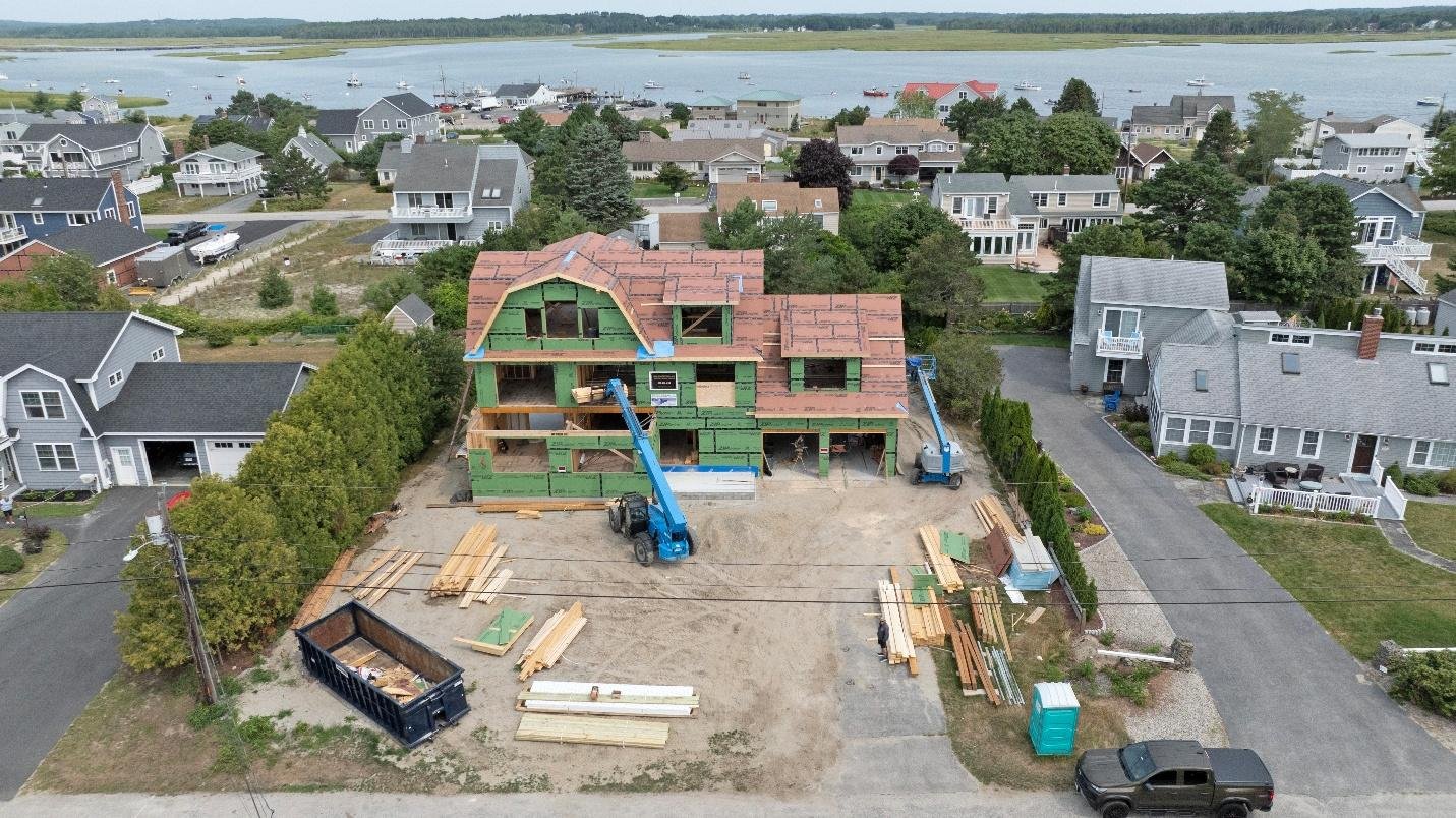
Drones provide access to hard-to-reach areas that manual inspections simply cannot safely reach. For example, inspecting steep roofs, tall chimneys, or coastal cliffs can be dangerous and costly, often requiring scaffolding, ladders, or even boat hires. With drones, these areas can be accessed safely and efficiently, reducing risks associated with fall-related injuries (which can cost $50,000 in claims).
Drone Benefits:
Drones also offer the option to use thermal cameras for moisture detection, revealing hidden issues like leaks or water damage that might otherwise go unnoticed.
For example, a Maine boathouse inspection that used to require boat rentals now takes just 15 minutes with drones, saving both time and money.
Manual photos taken from ladders or scaffolding often result in low-resolution, shaky images that lack detail and clarity. In contrast, drones capture 20MP stabilized images, 4K aerial video, and orthomosaic maps that provide crystal-clear imagery, far surpassing the quality of traditional methods.
Drone reports include:
The report-building process is fully automated and quick, with Quality Aerials delivering PDF and video reports with voiceovers in just 48 hours, enhancing realtor credibility with clients.
Safety is a top concern for real estate professionals, especially when it comes to inspecting tall buildings, roofs, and other hard-to-reach areas. Falls from ladders are one of the most common sources of injury in the real estate industry, often leading to costly worker compensation claims. Drones eliminate these safety risks by providing a safer alternative to manual inspections, with the added benefit of zero physical contact with elevated structures.
Key Safety Advantages of Drone Inspections:
By eliminating the physical risks associated with traditional methods and ensuring FAA compliance, drones provide a safer and more effective way to conduct property inspections, reducing potential liabilities for real estate professionals.
Real estate professionals can calculate the return on investment (ROI) of drone inspections by comparing the time and cost savings with the investment in drone services. The formula looks like this:
ROI = (Time Saved x Hourly Rate) + (Cost Avoided) = Return
For example, if an agent spends 4 hours on a traditional inspection that costs $1,500, and a drone service cuts the time to 30 minutes while costing only $400, the agent saves both time and money. If that time saved is valued at $100/hour, the ROI is:
ROI = (3.5 hours x $100/hour) + ($1,100 saved) = $1,850 ROI
This simple calculation demonstrates the significant cost savings and time efficiency that drone inspections provide to real estate professionals.
While drone inspections are beneficial, there are still some challenges that real estate professionals may face. The two main hurdles often cited are weather delays and the learning curve associated with integrating drone technology into existing inspection practices.
Although drones are weather-resistant, there are times when conditions such as heavy rain, snow, or wind exceed the operational limits of the drones. In these cases, Quality Aerials has a flexible scheduling system that works around weather conditions to ensure that inspections are completed as soon as the weather improves. FAA guidelines ensure that drones are not flown in adverse conditions, providing an extra layer of safety.
For professionals new to drone inspections, the initial learning curve may seem steep. However, once the benefits of drone services in Maine are understood, the technology becomes easier to integrate into regular inspections. Quality Aerials makes this process simple by providing guidance on how to incorporate drone footage into listings and reports. Additionally, our team of professional drone photographers is always available for consultations and support.

As technology continues to evolve, drone inspections are poised to become even more integral to the real estate industry. With advancements in drone mapping and inspection services, future drone inspections will offer even higher precision and capabilities. Features such as thermal imaging, high-resolution 3D mapping, and AI-powered analysis will allow real estate professionals to access detailed property reports with even more accuracy, providing a greater edge in competitive markets.
By staying ahead of these advancements, real estate professionals can continue to leverage drones to stay competitive in an ever-evolving market, improving both the efficiency and accuracy of property inspections.
Adopting drones for property inspections doesn’t need to be overwhelming. By integrating drone services into your existing workflow, real estate professionals can streamline the inspection process and improve overall efficiency. Here’s how to seamlessly incorporate drones into your business practices.
By following these steps, you can quickly integrate commercial drone services into your real estate business and start reaping the benefits of enhanced property marketing and faster inspections.
The advantages of using drones for real estate inspections are clear: they save time, reduce costs, and improve the accuracy and quality of reports. By choosing Quality Aerials, you’re partnering with a local, FAA-certified drone operator who understands the unique needs of Maine real estate professionals. With 24-48 hour reports, competitive pricing, and over 800 successful flights, we’re here to help you streamline your property inspections.
Contact us today to see how our drone inspection services can save you time and money, while providing high-quality imagery that enhances your real estate marketing efforts.