Construction planning in 2026 is more complex than ever. Projects move faster, budgets are tighter, and expectations for accuracy continue to rise. One missed detail can lead to delays, safety risks, or costly rework. This is where aerial photography has become a critical planning tool rather than a nice extra. By providing clear overhead visibility, drone imagery helps construction teams plan smarter, communicate better, and stay in control from the earliest stages through project completion.
Every construction project begins with understanding the site. Ground-level views can only show so much. They often hide layout challenges, access limitations, drainage patterns, or spatial conflicts that become problems later.
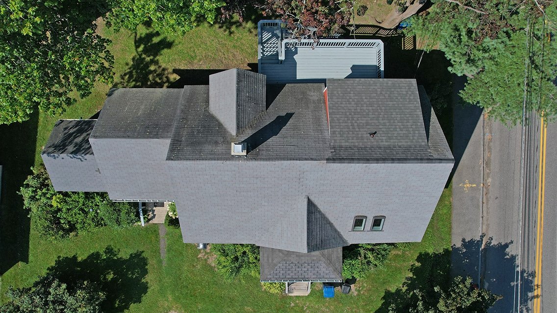
Aerial imagery solves this by showing the entire site at once. With high-resolution aerial photography, planners can see boundaries, elevation changes, nearby structures, and access points clearly. This broader perspective helps teams make informed decisions before work begins.
Better visibility at the planning stage reduces guesswork and prevents surprises once construction is underway.
Construction sites are dynamic environments. Equipment moves, materials shift, and progress changes daily. Relying on static ground photos often leads to incomplete or outdated information.
Aerial visuals provide a comprehensive overview that can be updated regularly. Overhead images show how different areas of a site relate to each other, which is essential for sequencing work and allocating resources.
Using aerial photography services in Maine, construction teams gain consistent visual documentation that supports clearer planning, scheduling, and coordination.
Before construction starts, teams must finalize layouts, staging areas, access routes, and safety zones. Mistakes during this phase can ripple through the entire project.
Aerial imagery supports pre-construction planning by:
When combined with drone mapping and inspection services, aerial photography adds measurable data to visual clarity. This improves accuracy and confidence in planning decisions.
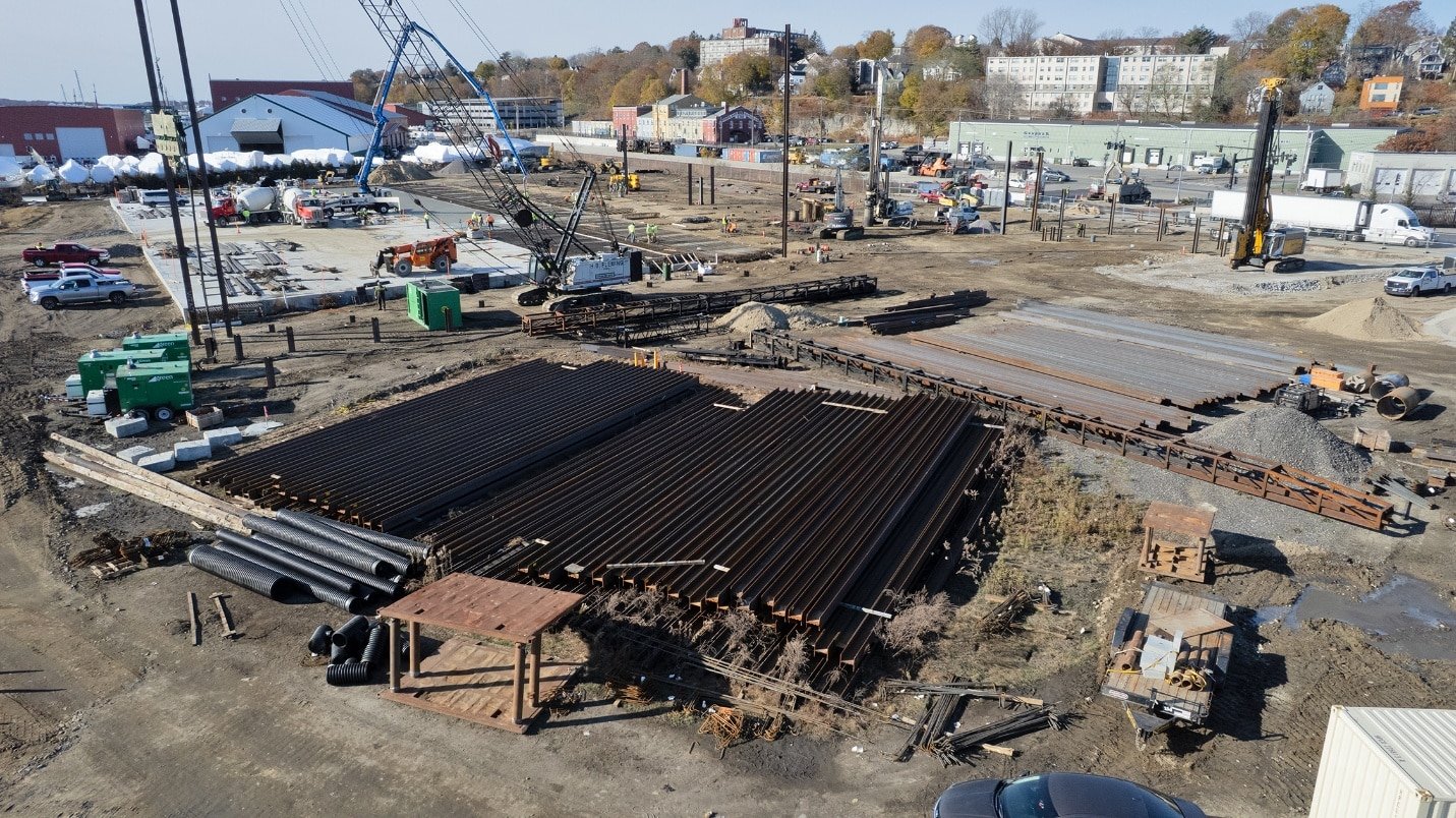
Logistics are a major challenge on construction sites. Poorly planned material storage or traffic flow can slow progress and increase safety risks.
Aerial views help planners design efficient layouts by showing:
This bird’s eye perspective makes it easier to optimize space and reduce congestion. Many construction firms now rely on construction site drone monitoring to adjust layouts as projects evolve.
Construction projects involve multiple teams, contractors, and stakeholders. Miscommunication is one of the leading causes of delays and disputes.
Aerial imagery improves communication by providing a shared visual reference. Instead of relying solely on drawings or descriptions, teams can point to actual site visuals that everyone understands.
This is especially useful for:
Using drone photography and videography, project managers can present clear visual updates that reduce misunderstandings and keep everyone aligned.
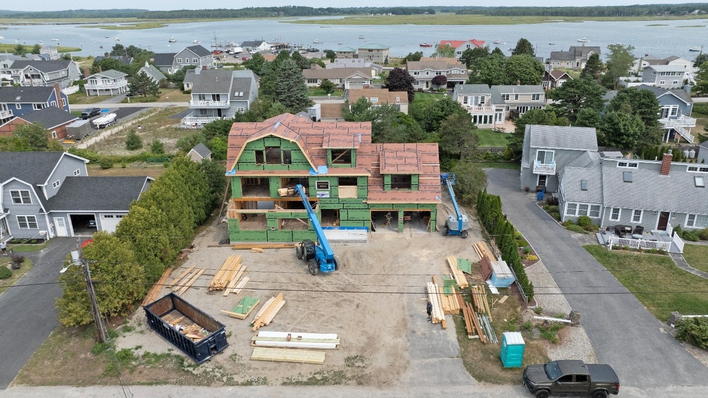
Progress tracking is essential for staying on schedule and within budget. Written reports and ground photos often fail to capture the full picture.
Aerial photography documents progress accurately over time. Overhead images show completed work, active zones, and areas yet to be developed. This makes it easier to compare planned versus actual progress.
With consistent aerial documentation, teams can identify delays early and adjust plans before issues escalate.
Safety is a top priority on any construction site. Identifying hazards early helps prevent accidents and downtime.
Aerial imagery supports safety planning by revealing:
Using drone inspection services, safety teams can assess conditions without putting workers at risk. This proactive approach improves compliance and reduces incidents.
Traditional inspections often require ladders, lifts, or scaffolding. These methods increase risk and slow down workflows.
Drone inspections offer a safer alternative. Drone roof inspection services allow teams to inspect roofs, structural elements, and hard-to-reach areas without physical access.
This is especially valuable during construction, when structures may not yet be fully secured. Drone inspections provide clear visuals while keeping workers safely on the ground.
Delays often stem from incomplete information. When planners lack a clear understanding of site conditions, mistakes happen.
Aerial photography reduces delays by:
Construction firms using commercial drone services in Maine often experience fewer surprises because they rely on up-to-date visual data rather than assumptions.
Construction projects generate extensive documentation. Accurate visual records are valuable for compliance, reporting, and dispute resolution.
Aerial imagery provides time-stamped documentation that shows site conditions at specific moments. This can support:
Clear aerial records protect both contractors and clients by providing objective visual evidence.
Not all drone imagery delivers the same value. Poor quality visuals can misrepresent conditions or create confusion.
Working with a professional drone photographer ensures images are clear, stable, and properly framed. Professionals also understand how to capture visuals that support planning rather than distract from it.
Many construction firms invest in structured drone photography packages to ensure consistent documentation throughout a project’s lifecycle.
Local knowledge plays an important role in construction photography. Weather patterns, terrain, and regulations vary by region.
Construction teams benefit from working with providers offering drone services in Maine who understand local conditions. Familiarity with seasonal weather and landscapes ensures smoother scheduling and more reliable results.
This is one reason many firms seek partnerships with the top drone companies in their region rather than relying on one-off providers.
While planning and documentation are primary uses, aerial visuals also support project promotion. Construction companies use visuals to showcase completed work and attract future clients.
High-quality imagery and drone marketing videos highlight scale, complexity, and craftsmanship. This strengthens a firm’s portfolio and supports business development efforts.
Aerial photography delivers value at every stage of a construction project, not just during early planning. As sites evolve, overhead visuals help teams adapt quickly and maintain control.
During excavation and groundwork, aerial imagery confirms site preparation accuracy. As structures rise, overhead documentation shows progress clearly and consistently. In later stages, aerial visuals support final inspections, handovers, and long-term records.
By using drone photography and videography throughout the project lifecycle, construction teams gain continuity. Each phase builds on the last with clear visual evidence rather than assumptions or fragmented reports.
Large construction projects often involve multiple trades working simultaneously. Coordination issues can lead to delays, rework, and safety concerns.
Aerial imagery provides a shared reference point for everyone involved. Overhead visuals show where work is happening, which areas are restricted, and how different tasks interact spatially.
This clarity supports:
Teams using construction site drone monitoring often report smoother coordination because everyone can see the same up-to-date site conditions.
Not every stakeholder can be on site every day. Owners, investors, and senior managers often rely on reports to stay informed.
Aerial imagery bridges this gap. Clear overhead photos and videos allow remote stakeholders to understand progress without visiting the site. This saves time while improving confidence in project updates.
Using drone mapping and inspection services, teams can provide accurate visual data that supports remote decision-making. This is especially valuable for projects spread across multiple locations or regions.
Small issues can quickly become major problems if they go unnoticed. Drainage concerns, material placement errors, or access limitations often appear subtle from the ground.
Aerial photography highlights these issues early. Overhead views reveal patterns and inconsistencies that are easy to miss otherwise.
By identifying problems sooner, teams can adjust plans before delays or budget overruns occur. This proactive approach is one of the strongest benefits of using drone inspection services in construction planning.
Safety audits are a routine part of construction management. Traditional audits often require physical walkthroughs and manual documentation.
Aerial imagery supports safer and more efficient audits by allowing teams to review conditions remotely. Overhead visuals show site layout, traffic flow, and restricted zones clearly.
When combined with drone roof inspection services, safety teams can assess elevated areas without exposing workers to unnecessary risk. This approach improves compliance while reinforcing a culture of safety.
Construction disputes often arise from unclear documentation. When timelines, responsibilities, or conditions are questioned, visual records become invaluable.
Aerial photography provides time-stamped documentation that shows site conditions at specific points. These records support:
Clear aerial documentation protects all parties by providing objective evidence rather than relying on recollection or incomplete records.
Many construction projects must consider environmental impact, land use regulations, and surrounding conditions. Aerial imagery supports these requirements by showing how a site interacts with its environment.
Overhead visuals help teams:
Using aerial photography services in Maine, construction firms gain region-specific insight that reflects local terrain and seasonal changes accurately.
Construction projects often span months or years. Inconsistent documentation creates gaps that reduce clarity and usefulness.
Structured aerial documentation ensures consistency. Many firms rely on ongoing drone photography packages to capture visuals at regular intervals. This creates a reliable visual timeline from start to finish.
Consistency improves:
It also simplifies reporting by providing a predictable format for updates.
Not all drone providers understand construction needs. Choosing the right partner is essential for getting practical value from aerial imagery.
A professional drone photographer experienced in construction knows how to capture angles that support planning, inspections, and documentation. They understand what details matter and how to present them clearly.
Construction firms in the region often seek commercial drone services in Maine because local providers understand weather patterns, terrain, and regulations. This local expertise reduces delays and improves reliability.
Drone operations must follow strict regulations, especially on active construction sites. Improper operation can cause delays or legal issues.
Working with experienced providers offering drone services in Maine ensures compliance with flight rules, safety standards, and site requirements. This protects both the construction firm and the client.
Reliable providers handle planning, permissions, and execution professionally, allowing construction teams to focus on their work.
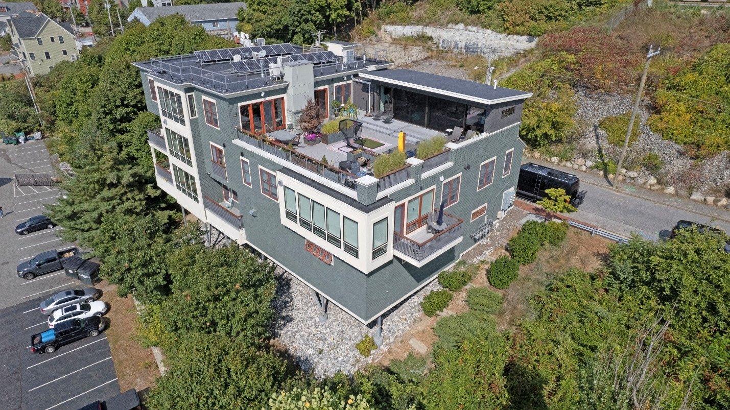
Once a project is complete, aerial imagery continues to deliver value. Construction firms use visuals to showcase their work and attract new clients.
High-quality imagery and drone marketing videos highlight scale, complexity, and craftsmanship. These visuals strengthen portfolios, proposals, and online presence.
Completed project visuals help firms demonstrate capability and professionalism without relying solely on written descriptions.
After construction ends, property owners still benefit from aerial documentation. Overhead visuals support maintenance planning, inspections, and future upgrades.
Clear records help owners understand original layouts and conditions. This simplifies renovations, expansions, or resale planning later.
Aerial imagery becomes a long-term asset rather than a short-term tool.
In 2026, aerial photography is no longer a novelty in construction planning. It is becoming a standard practice across the industry.
Firms that adopt drone imagery benefit from:
Those who rely solely on traditional methods often struggle to keep pace with modern expectations.
Clear planning starts with clear visibility. Aerial photography provides construction teams with the insight they need to plan accurately, manage risk, and deliver successful projects.
Quality Aerials offers professional drone photography, videography, and inspection solutions tailored to construction planning needs. As a trusted local provider serving Maine and the Northeast, we combine technical expertise with dependable service and fast turnaround times.
If you are ready to improve construction planning, enhance site visibility, and strengthen documentation, contact Quality Aerials today to discuss your project and discover how aerial photography can support every stage of construction.