There’s a moment that happens in a lot of inspections: everything looks “mostly fine” from the ground—until you finally get the angle you actually need. The challenge isn’t experience or effort. It’s visibility. Buildings, roofs, and large assets are full of tight corners, steep pitches, hidden transitions, and elevated components that are difficult to see clearly and safely from ground level.
That’s exactly where drones change the quality of what you can verify. With modern aerial imaging, we can access viewpoints that used to require significant risk, time, or expensive access equipment—and we can do it with consistent coverage and clear documentation. Whether you’re evaluating storm impact, checking ongoing wear, or simply trying to understand what’s happening on a roof before you commit to repairs, drone roof inspection services help you see the full surface from the best possible angles.
In this guide, we’ll break down what drones can reveal that traditional ground inspections often miss, why that matters for decision-making, and how we use aerial visuals to help property owners, contractors, and businesses move forward with confidence. If you want a sense of the types of projects we support, you can explore our Services page.
The Real Limits of Ground-Level Inspections
Even the best technician is limited by one simple fact: you can only assess what you can actually see. On paper, a ground inspection sounds straightforward—walk the perimeter, note visible issues, and climb where necessary. In real conditions, visibility is shaped by access, angles, safety, and time.
From the ground, rooflines compress. Subtle dips and uneven planes can disappear because your viewpoint is working against you. A roof edge can hide a gutter problem. A chimney can block the view of a transition behind it. Flashing—often one of the most important areas to inspect—may be partly obscured from every safe ladder position. And while a technician may reach some critical points, doing so safely can take multiple setups, extra hands, or equipment that isn’t always practical for a first-stage assessment.
Then there’s the reality that “reachable” doesn’t always mean “inspectable.” Roof pitch, roof height, fragile surfaces, loose material, wet conditions, and high winds all reduce what can reasonably be checked by foot. Even when climbing is possible, it’s not always efficient to spend time getting onto a roof just to confirm whether a concern exists. Often, what’s needed first is clarity: Where is the issue? How widespread is it? What is actually happening across the surface?
In Maine, the constraints can be even more pronounced. Snow load, ice dams, freeze-thaw cycles, and winter storms all leave signatures that aren’t always obvious from street level. Coastal exposure adds another layer: salt air and sustained winds can accelerate wear, and damage may appear as a pattern across a roof plane rather than at a single obvious failure point.
Ground inspections absolutely have value. But they’re often forced to be selective: check what’s reachable, focus on likely problem areas, and make reasonable assumptions about everything else. The problem is that assumptions can become expensive when a hidden issue becomes a leak, a delay, or an unexpected repair scope.
Getting Eyes on Difficult or Unsafe Areas
One of the biggest advantages of a drone is simple: it reaches viewpoints people shouldn’t have to.
A drone doesn’t get tired. It doesn’t rely on the one ladder position that fits the site. It can approach from multiple sides, capture the roof plane at a consistent height, and zoom in on points of interest—without putting a person on a steep surface or asking someone to lean into a risky angle just to “get a look.”
Roof edges, chimneys, and tight angles
Some of the most critical roof issues occur where materials meet and where water moves. Edges and transitions are prime locations for small failures that grow over time: lifted flashing, degraded sealant, missing or curling shingles, debris buildup, or gutters that aren’t draining as intended.
These areas can be hard to view from the ground because they’re often tucked behind fascia lines, parapets, dormers, or roof features. And while it’s possible to inspect some edges from a ladder, ladders don’t give you a consistent perspective across the entire perimeter. One section might be easy; another might be blocked by landscaping, tight setbacks, uneven ground, or limited access around the building.
With a drone, we can capture the roof edge and perimeter in a way that’s more complete and repeatable. Instead of piecing together partial observations, you get a set of visuals that show how the roof behaves as a whole: where debris collects, where water might be backing up, and which transitions deserve closer attention.
Tall structures and hard-to-reach exteriors
It’s not just roofs. Many properties include elevated or vertical elements that are awkward, time-consuming, or risky to inspect from the ground: upper façades, parapets, exterior walls on multi-story buildings, cupolas, tall chimneys, rooftop units, or architectural features that create blind spots.
Traditional access solutions can be effective, but they can also be expensive and disruptive—especially when a visual assessment is the first priority. A drone allows us to gather high-angle exterior views with less setup and fewer constraints, helping you confirm whether further access equipment is warranted.
Remote or restricted access sites
Some sites are difficult because of the terrain. Others are difficult because of logistics: tight urban footprints, waterfront property lines, active job sites, or facilities where operations cannot be disrupted for long.
In those scenarios, a drone can reduce disruption by gathering comprehensive visuals in a shorter window. The goal isn’t just convenience. It’s fewer delays, fewer safety compromises, and better information up front—so any follow-up work is targeted and efficient.
High-Angle Visuals That Tell the Whole Story
A drone doesn’t just fly higher. It changes how the story of a structure is seen.
From above, patterns become clearer. You can see how water likely travels across a roof surface. You can spot areas where materials are aging unevenly. You can identify irregular lines, shifting, or subtle sagging that doesn’t stand out when you’re looking up from the ground. You can also capture angles that show both the “macro” view (the full plane) and the “micro” view (the details) without losing context.
That context matters because a close-up photo alone can be misleading. A technician might capture a tight shot of a suspicious area, but that image may not show whether the issue is isolated or part of a larger pattern. Aerial visuals can capture the full roof plane, then tighten in to document the exact detail—so you can interpret the evidence in context rather than in isolation.
This is where drone mapping and inspection services become especially useful for property owners and project teams. The aim is not simply to “take pictures from above.” It’s to provide a more comprehensive visual record that supports clear decisions: what needs attention, what can wait, and what’s actually happening across the asset.
Our approach is built around practical deliverables—clear visuals that are easy to understand and share with the people involved in repairs, maintenance, or planning. If you’d like to learn more about our background and the standards we bring to each flight, you can visit our About Us page.
Hidden Issues Drones Reveal Faster
Many structural issues aren’t hidden because they’re impossible to find—they’re hidden because they’re difficult to confirm without the right viewpoint.
A drone’s advantage is that it can quickly capture the angles that make certain problems visible. Instead of spending time setting up access equipment just to confirm whether a concern exists, aerial visuals can provide a clear answer early in the process.
Structural “clues” you can’t see from the ground
From an elevated perspective, we can often document visual indicators that are easy to miss at street level, such as:
- Shingle and surface damage patterns: A single missing shingle may be visible from the ground, but patterns—like uplift, shifting, or wear in specific zones—often become clear only from above.
- Transition vulnerabilities: Areas around skylights, vents, chimneys, and roof intersections can show subtle separation or deterioration that is hard to confirm from a ground angle.
- Drainage issues: Pooling, staining patterns, or debris accumulation can suggest water movement problems that may not be obvious without a full-plane view.
- Edge and gutter concerns: Blockages, sagging sections, or overflow indicators often show up as visible debris lines or uneven gutter runs.
- Roof plane irregularities: Slight dips, waves, or distortions can signal settling or structural changes that don’t read clearly from below.
- Upper exterior wear: Cracks, gaps, and material wear on upper façades or architectural features can be difficult to assess without an elevated viewpoint.
What makes this especially valuable is speed. A drone can often capture the “yes/no” evidence quickly, allowing you to plan the next step with confidence. That might mean scheduling a targeted repair, bringing in the right trade, or deciding that a full hands-on inspection is warranted in a specific area—rather than committing to broad access efforts across the entire structure.
Context changes decisions
A drone also helps prevent misdiagnosis. A problem that looks isolated from the ground can appear far more widespread from above. Conversely, something that looks alarming up close might be superficial once you see the surrounding area and understand how it connects to the roof’s overall condition.
Context influences scope, budget, and urgency. Better visuals reduce guesswork and help you act based on what’s actually there.
Better Documentation, Better Decisions
If you’ve ever coordinated repairs, insurance conversations, property maintenance planning, or construction timelines, you already know this: documentation changes the speed of everything.
Clear visuals reduce debate. They speed up approvals. They make it easier for multiple stakeholders to align without the need for endless back-and-forth. And they create a record you can return to later when questions come up.
Progress tracking and comparisons over time
One of the most useful (and underrated) benefits of drone capture is repeatability. Aerial documentation can be collected from consistent angles over time, making it easier to track change, compare conditions, and verify progress.
This is valuable when:
- You’re monitoring ongoing wear and planning maintenance cycles
- You’re documenting post-storm conditions and building a visual record
- You’re verifying that repairs were completed as expected
- You’re creating a “before and after” record for accountability
- You’re coordinating multiple trades and need everyone aligned on what’s been done
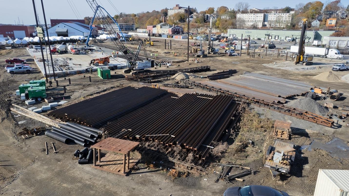
For active job sites, this becomes even more impactful when paired with construction site drone monitoring. Aerial updates can clearly show site progress, support planning conversations, and provide stakeholders with a shared reference point—without requiring everyone to be on-site every time there’s a milestone or concern.
Faster stakeholder alignment
Drones also reduce communication friction. Instead of trying to describe a concern in words, you can show it. Instead of debating what’s visible, multiple parties can review the same images. That’s useful across roles:
- Property owners and managers
- Contractors and trades
- Consultants and adjusters
- Real estate and development teams
- Facility and maintenance leadership
If you want to see the kinds of perspectives we capture and the visual quality we deliver, our Gallery includes a range of aerial examples across different project types.
Drones Don’t Replace Technicians – They Upgrade the Inspection
It’s important to say clearly: drones are not a replacement for skilled technicians. They’re a tool that improves safety, reduces wasted effort, and makes inspections more accurate.
A drone can show you what’s happening across an asset. A technician can confirm causes, test materials, and complete repairs. When used together, you get a stronger workflow:
- Use aerial visuals to understand the full asset and identify concerns
- Reduce unnecessary climbs by focusing hands-on inspection only where it’s needed
- Share clear documentation with stakeholders before decisions are made
- Return to consistent angles later for progress tracking or verification
This saves time because the “first look” becomes much more informative. It improves safety because fewer people need to access risky areas just to gather basic information. And it reduces surprises because the documentation is more complete from the start.
In practical terms, drones add a strong visual layer to the inspection process—one that helps technicians arrive prepared, helps owners understand what they’re seeing, and helps teams act based on evidence rather than assumptions.
A Clearer View Means Smarter Action
When you compare a drone-led visual assessment to a ground-only inspection, the biggest difference isn’t the technology—it’s the completeness of the view. Drones help us access difficult or unsafe areas, capture high-angle visuals that reveal patterns and context, and document issues clearly enough to support faster decisions.
If you’re looking for drone inspection services in Maine, we’re built for exactly this kind of work: efficient capture, sharp aerial visuals, and deliverables that are genuinely useful for planning, repairs, or stakeholder communication.
We can also deploy a thermal drone with an infrared camera for inspections and energy audits. It helps pinpoint heat loss, moisture intrusion, and electrical hotspots—often before there are any visible signs—so you can catch problems early and plan the right next step.
At Quality Aerials, every flight is handled by an FAA-certified drone operator in Maine, and we take a practical, professional approach to every project—focused on safety, reliability, and clear results. To see how we can support your next inspection or documentation need, explore our Services, and when you’re ready to get started, contact us here.